Skip to Content
Toggle navigation
UC Santa Cruz
University Library
Contact Us
Browse Collections
Digital Collections
Photographs, audio recordings, publications, and more from our Special Collections & Archives
Search
Search
Search Constraints
Start Over
Filtering by:
Description
At North Beach carnival
Remove constraint Description: At North Beach carnival
Sort by relevance
relevance
Title ▼
Title ▲
Date Created ▼
Date Created ▲
Number of results to display per page
24 per page
10
per page
20
per page
24
per page
50
per page
100
per page
View results as:
List
Gallery
Masonry
Search Results
80 results for:
At North Beach carnival
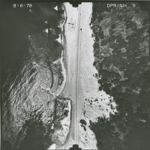
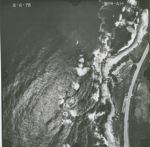
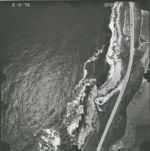
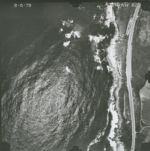
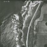
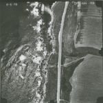
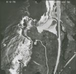
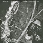
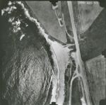
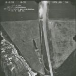
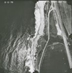
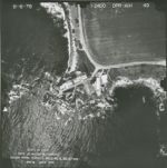
1978-C/D California Coastline Flight DPR-AIH 9
Title:
1978-C/D California Coastline Flight DPR-AIH 9
Creator:
Genge Aerial Surveys
Type:
Image
Date Created:
[1978]
Description:
Santa Cruz County coastline at Waddell Beach to San Mateo County line; San Mateo County beaches: from San Mateo County line north ca 2.5 miles; from ca. 1 mile east of Ano Nuevo Point to the Point; at Gazos Creek for 3/4 mile south; at Pigeon Point; ca 1 mile north to 1 mile south; from 1/4 mile south of Bean Hollow Ranch to Pescadero Point.
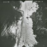
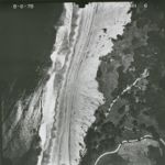
1978-C/D California Coastline Flight DPR-AIH 8
Title:
1978-C/D California Coastline Flight DPR-AIH 8
Creator:
Genge Aerial Surveys
Type:
Image
Date Created:
[1978]
Description:
Santa Cruz County coastline at Waddell Beach to San Mateo County line; San Mateo County beaches: from San Mateo County line north ca 2.5 miles; from ca. 1 mile east of Ano Nuevo Point to the Point; at Gazos Creek for 3/4 mile south; at Pigeon Point; ca 1 mile north to 1 mile south; from 1/4 mile south of Bean Hollow Ranch to Pescadero Point.
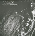
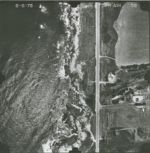
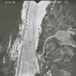
1978-C/D California Coastline Flight DPR-AIH 64
Title:
1978-C/D California Coastline Flight DPR-AIH 64
Creator:
Genge Aerial Surveys
Type:
Image
Date Created:
[1978]
Description:
Santa Cruz County coastline at Waddell Beach to San Mateo County line; San Mateo County beaches: from San Mateo County line north ca 2.5 miles; from ca. 1 mile east of Ano Nuevo Point to the Point; at Gazos Creek for 3/4 mile south; at Pigeon Point; ca 1 mile north to 1 mile south; from 1/4 mile south of Bean Hollow Ranch to Pescadero Point.
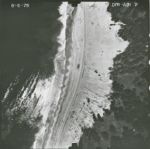
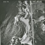
1978-C/D California Coastline Flight DPR-AIH 7
Title:
1978-C/D California Coastline Flight DPR-AIH 7
Creator:
Genge Aerial Surveys
Type:
Image
Date Created:
[1978]
Description:
Santa Cruz County coastline at Waddell Beach to San Mateo County line; San Mateo County beaches: from San Mateo County line north ca 2.5 miles; from ca. 1 mile east of Ano Nuevo Point to the Point; at Gazos Creek for 3/4 mile south; at Pigeon Point; ca 1 mile north to 1 mile south; from 1/4 mile south of Bean Hollow Ranch to Pescadero Point.
1978-C/D California Coastline Flight DPR-AIH 63
Title:
1978-C/D California Coastline Flight DPR-AIH 63
Creator:
Genge Aerial Surveys
Type:
Image
Date Created:
[1978]
Description:
Santa Cruz County coastline at Waddell Beach to San Mateo County line; San Mateo County beaches: from San Mateo County line north ca 2.5 miles; from ca. 1 mile east of Ano Nuevo Point to the Point; at Gazos Creek for 3/4 mile south; at Pigeon Point; ca 1 mile north to 1 mile south; from 1/4 mile south of Bean Hollow Ranch to Pescadero Point.
1978-C/D California Coastline Flight DPR-AIH 61
Title:
1978-C/D California Coastline Flight DPR-AIH 61
Creator:
Genge Aerial Surveys
Type:
Image
Date Created:
[1978]
Description:
Santa Cruz County coastline at Waddell Beach to San Mateo County line; San Mateo County beaches: from San Mateo County line north ca 2.5 miles; from ca. 1 mile east of Ano Nuevo Point to the Point; at Gazos Creek for 3/4 mile south; at Pigeon Point; ca 1 mile north to 1 mile south; from 1/4 mile south of Bean Hollow Ranch to Pescadero Point.
1978-C/D California Coastline Flight DPR-AIH 62
Title:
1978-C/D California Coastline Flight DPR-AIH 62
Creator:
Genge Aerial Surveys
Type:
Image
Date Created:
[1978]
Description:
Santa Cruz County coastline at Waddell Beach to San Mateo County line; San Mateo County beaches: from San Mateo County line north ca 2.5 miles; from ca. 1 mile east of Ano Nuevo Point to the Point; at Gazos Creek for 3/4 mile south; at Pigeon Point; ca 1 mile north to 1 mile south; from 1/4 mile south of Bean Hollow Ranch to Pescadero Point.
1978-C/D California Coastline Flight DPR-AIH 60
Title:
1978-C/D California Coastline Flight DPR-AIH 60
Creator:
Genge Aerial Surveys
Type:
Image
Date Created:
[1978]
Description:
Santa Cruz County coastline at Waddell Beach to San Mateo County line; San Mateo County beaches: from San Mateo County line north ca 2.5 miles; from ca. 1 mile east of Ano Nuevo Point to the Point; at Gazos Creek for 3/4 mile south; at Pigeon Point; ca 1 mile north to 1 mile south; from 1/4 mile south of Bean Hollow Ranch to Pescadero Point.
1978-C/D California Coastline Flight DPR-AIH 59
Title:
1978-C/D California Coastline Flight DPR-AIH 59
Creator:
Genge Aerial Surveys
Type:
Image
Date Created:
[1978]
Description:
Santa Cruz County coastline at Waddell Beach to San Mateo County line; San Mateo County beaches: from San Mateo County line north ca 2.5 miles; from ca. 1 mile east of Ano Nuevo Point to the Point; at Gazos Creek for 3/4 mile south; at Pigeon Point; ca 1 mile north to 1 mile south; from 1/4 mile south of Bean Hollow Ranch to Pescadero Point.
1978-C/D California Coastline Flight DPR-AIH 6
Title:
1978-C/D California Coastline Flight DPR-AIH 6
Creator:
Genge Aerial Surveys
Type:
Image
Date Created:
[1978]
Description:
Santa Cruz County coastline at Waddell Beach to San Mateo County line; San Mateo County beaches: from San Mateo County line north ca 2.5 miles; from ca. 1 mile east of Ano Nuevo Point to the Point; at Gazos Creek for 3/4 mile south; at Pigeon Point; ca 1 mile north to 1 mile south; from 1/4 mile south of Bean Hollow Ranch to Pescadero Point.
1978-C/D California Coastline Flight DPR-AIH 58
Title:
1978-C/D California Coastline Flight DPR-AIH 58
Creator:
Genge Aerial Surveys
Type:
Image
Date Created:
[1978]
Description:
Santa Cruz County coastline at Waddell Beach to San Mateo County line; San Mateo County beaches: from San Mateo County line north ca 2.5 miles; from ca. 1 mile east of Ano Nuevo Point to the Point; at Gazos Creek for 3/4 mile south; at Pigeon Point; ca 1 mile north to 1 mile south; from 1/4 mile south of Bean Hollow Ranch to Pescadero Point.
1978-C/D California Coastline Flight DPR-AIH 57
Title:
1978-C/D California Coastline Flight DPR-AIH 57
Creator:
Genge Aerial Surveys
Type:
Image
Date Created:
[1978]
Description:
Santa Cruz County coastline at Waddell Beach to San Mateo County line; San Mateo County beaches: from San Mateo County line north ca 2.5 miles; from ca. 1 mile east of Ano Nuevo Point to the Point; at Gazos Creek for 3/4 mile south; at Pigeon Point; ca 1 mile north to 1 mile south; from 1/4 mile south of Bean Hollow Ranch to Pescadero Point.
1978-C/D California Coastline Flight DPR-AIH 56
Title:
1978-C/D California Coastline Flight DPR-AIH 56
Creator:
Genge Aerial Surveys
Type:
Image
Date Created:
[1978]
Description:
Santa Cruz County coastline at Waddell Beach to San Mateo County line; San Mateo County beaches: from San Mateo County line north ca 2.5 miles; from ca. 1 mile east of Ano Nuevo Point to the Point; at Gazos Creek for 3/4 mile south; at Pigeon Point; ca 1 mile north to 1 mile south; from 1/4 mile south of Bean Hollow Ranch to Pescadero Point.
1978-C/D California Coastline Flight DPR-AIH 55
Title:
1978-C/D California Coastline Flight DPR-AIH 55
Creator:
Genge Aerial Surveys
Type:
Image
Date Created:
[1978]
Description:
Santa Cruz County coastline at Waddell Beach to San Mateo County line; San Mateo County beaches: from San Mateo County line north ca 2.5 miles; from ca. 1 mile east of Ano Nuevo Point to the Point; at Gazos Creek for 3/4 mile south; at Pigeon Point; ca 1 mile north to 1 mile south; from 1/4 mile south of Bean Hollow Ranch to Pescadero Point.
1978-C/D California Coastline Flight DPR-AIH 53
Title:
1978-C/D California Coastline Flight DPR-AIH 53
Creator:
Genge Aerial Surveys
Type:
Image
Date Created:
[1978]
Description:
Santa Cruz County coastline at Waddell Beach to San Mateo County line; San Mateo County beaches: from San Mateo County line north ca 2.5 miles; from ca. 1 mile east of Ano Nuevo Point to the Point; at Gazos Creek for 3/4 mile south; at Pigeon Point; ca 1 mile north to 1 mile south; from 1/4 mile south of Bean Hollow Ranch to Pescadero Point.
1978-C/D California Coastline Flight DPR-AIH 54
Title:
1978-C/D California Coastline Flight DPR-AIH 54
Creator:
Genge Aerial Surveys
Type:
Image
Date Created:
[1978]
Description:
Santa Cruz County coastline at Waddell Beach to San Mateo County line; San Mateo County beaches: from San Mateo County line north ca 2.5 miles; from ca. 1 mile east of Ano Nuevo Point to the Point; at Gazos Creek for 3/4 mile south; at Pigeon Point; ca 1 mile north to 1 mile south; from 1/4 mile south of Bean Hollow Ranch to Pescadero Point.
1978-C/D California Coastline Flight DPR-AIH 52
Title:
1978-C/D California Coastline Flight DPR-AIH 52
Creator:
Genge Aerial Surveys
Type:
Image
Date Created:
[1978]
Description:
Santa Cruz County coastline at Waddell Beach to San Mateo County line; San Mateo County beaches: from San Mateo County line north ca 2.5 miles; from ca. 1 mile east of Ano Nuevo Point to the Point; at Gazos Creek for 3/4 mile south; at Pigeon Point; ca 1 mile north to 1 mile south; from 1/4 mile south of Bean Hollow Ranch to Pescadero Point.
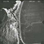
1978-C/D California Coastline Flight DPR-AIH 50
Title:
1978-C/D California Coastline Flight DPR-AIH 50
Creator:
Genge Aerial Surveys
Type:
Image
Date Created:
[1978]
Description:
Santa Cruz County coastline at Waddell Beach to San Mateo County line; San Mateo County beaches: from San Mateo County line north ca 2.5 miles; from ca. 1 mile east of Ano Nuevo Point to the Point; at Gazos Creek for 3/4 mile south; at Pigeon Point; ca 1 mile north to 1 mile south; from 1/4 mile south of Bean Hollow Ranch to Pescadero Point.
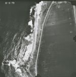
1978-C/D California Coastline Flight DPR-AIH 51
Title:
1978-C/D California Coastline Flight DPR-AIH 51
Creator:
Genge Aerial Surveys
Type:
Image
Date Created:
[1978]
Description:
Santa Cruz County coastline at Waddell Beach to San Mateo County line; San Mateo County beaches: from San Mateo County line north ca 2.5 miles; from ca. 1 mile east of Ano Nuevo Point to the Point; at Gazos Creek for 3/4 mile south; at Pigeon Point; ca 1 mile north to 1 mile south; from 1/4 mile south of Bean Hollow Ranch to Pescadero Point.
1978-C/D California Coastline Flight DPR-AIH 5
Title:
1978-C/D California Coastline Flight DPR-AIH 5
Creator:
Genge Aerial Surveys
Type:
Image
Date Created:
[1978]
Description:
Santa Cruz County coastline at Waddell Beach to San Mateo County line; San Mateo County beaches: from San Mateo County line north ca 2.5 miles; from ca. 1 mile east of Ano Nuevo Point to the Point; at Gazos Creek for 3/4 mile south; at Pigeon Point; ca 1 mile north to 1 mile south; from 1/4 mile south of Bean Hollow Ranch to Pescadero Point.
1978-C/D California Coastline Flight DPR-AIH 49
Title:
1978-C/D California Coastline Flight DPR-AIH 49
Creator:
Genge Aerial Surveys
Type:
Image
Date Created:
[1978]
Description:
Santa Cruz County coastline at Waddell Beach to San Mateo County line; San Mateo County beaches: from San Mateo County line north ca 2.5 miles; from ca. 1 mile east of Ano Nuevo Point to the Point; at Gazos Creek for 3/4 mile south; at Pigeon Point; ca 1 mile north to 1 mile south; from 1/4 mile south of Bean Hollow Ranch to Pescadero Point.
1978-C/D California Coastline Flight DPR-AIH 48
Title:
1978-C/D California Coastline Flight DPR-AIH 48
Creator:
Genge Aerial Surveys
Type:
Image
Date Created:
[1978]
Description:
Santa Cruz County coastline at Waddell Beach to San Mateo County line; San Mateo County beaches: from San Mateo County line north ca 2.5 miles; from ca. 1 mile east of Ano Nuevo Point to the Point; at Gazos Creek for 3/4 mile south; at Pigeon Point; ca 1 mile north to 1 mile south; from 1/4 mile south of Bean Hollow Ranch to Pescadero Point.
1978-C/D California Coastline Flight DPR-AIH 47
Title:
1978-C/D California Coastline Flight DPR-AIH 47
Creator:
Genge Aerial Surveys
Type:
Image
Date Created:
[1978]
Description:
Santa Cruz County coastline at Waddell Beach to San Mateo County line; San Mateo County beaches: from San Mateo County line north ca 2.5 miles; from ca. 1 mile east of Ano Nuevo Point to the Point; at Gazos Creek for 3/4 mile south; at Pigeon Point; ca 1 mile north to 1 mile south; from 1/4 mile south of Bean Hollow Ranch to Pescadero Point.
1978-C/D California Coastline Flight DPR-AIH 45
Title:
1978-C/D California Coastline Flight DPR-AIH 45
Creator:
Genge Aerial Surveys
Type:
Image
Date Created:
[1978]
Description:
Santa Cruz County coastline at Waddell Beach to San Mateo County line; San Mateo County beaches: from San Mateo County line north ca 2.5 miles; from ca. 1 mile east of Ano Nuevo Point to the Point; at Gazos Creek for 3/4 mile south; at Pigeon Point; ca 1 mile north to 1 mile south; from 1/4 mile south of Bean Hollow Ranch to Pescadero Point.
Previous
1
2
3
4
Next
Show Filters
Limit your search
Creator
Genge Aerial Surveys
72
Baruch, Ruth-Marion, 1922-1997
8
Type
Image
79
Collection
1
Series
Children
8
Place
North Beach
8
San Mateo
1
Collection
UC Santa Cruz Aerial Photographs Collection
72
1978-C/D California Coastline Flight DPR-AIH
71
Children
8
Ruth-Marion Baruch and Pirkle Jones Photographs
8
×
Digital Collections Feedback