Search Constraints
Number of results to display per page
Search Results
460 results for:
-
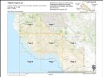
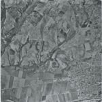
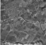
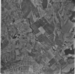
1969-G Pajaro River and Vicinity Flight PR
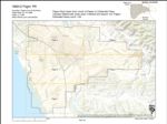 Type:Place:Date Created:[1969]Subject:Monterey County, Watsonville Municipal Airport, Freedom, Watsonville, Santa Cruz County, and Pajaro RiverCall Number:1969-G
 -
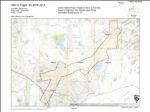
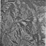
1989-I Monterey Bay Coastline Flight USGS Monterey Bay
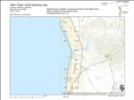 Variant Title:Creator:Type:Place:Topic:Date Created:1989Description:Subject:Coasts--California, Santa Cruz County, Salinas, Elkhorn Slough, Moss Landing, Watsonville, Monterey County, Pajaro Valley, and MarinaCall Number:1989-I
 -
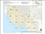
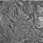
1984-C California Highway Route 129 Flight 04-SCR-129
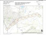 Creator:Type:Place:Date Created:1984Subject:Santa Cruz County and WatsonvilleCall Number:1984-C
 -
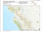
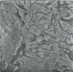
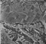
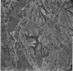
1974-Color San Andreas Fault Zone Flight
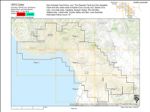 Variant Title:Creator:Type:Place:Date Created:1974Subject:Santa Cruz County, San Andreas Fault, Castroville, Capitola, Watsonville, Aptos, San Juan Bautista, Scotts Valley, and Soquel
 -
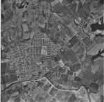
1966-D San Andreas Fault Zone Flight
 Variant Title:Creator:Type:Place:Date Created:[1966]Subject:Santa Cruz County, San Andreas Fault, Los Gatos, Santa Clara, San Francisco, San Benito, San Mateo, Saratoga, Watsonville, Monterey County, and Palo AltoCall Number:1966-D
 -
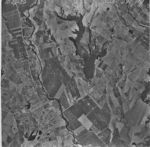
1963-E Santa Cruz County Flight CJA
 Variant Title:Type:Place:Santa Cruz County, Ben Lomond, Watsonville Municipal Airport, Capitola, Felton, Santa Cruz, Santa Clara, Santa Cruz Small Craft Harbor, The Forest of Nisene Marks State Park, University of California Santa Cruz, San Lorenzo River Mouth, San Lorenzo Valley, Live Oak, Pogonip, San Mateo, Greyhound Rock, Natural Bridges State Beach, La Selva Beach, Watsonville, Corralitos, Scotts Valley, Lighthouse Field, Monterey County, Waddell Creek, Wilder Ranch State Park, Soquel Point, Big Basin Redwoods State Park, Pajaro Valley, Boulder Creek, and AptosDate Created:1963Subject:Santa Cruz County, Ben Lomond, Watsonville Municipal Airport, Capitola, Felton, Santa Cruz, Santa Clara, Santa Cruz Small Craft Harbor, The Forest of Nisene Marks State Park, University of California Santa Cruz, San Lorenzo River Mouth, San Lorenzo Valley, Live Oak, Pogonip, San Mateo, Greyhound Rock, Natural Bridges State Beach, La Selva Beach, Watsonville, Corralitos, Scotts Valley, Lighthouse Field, Monterey County, Waddell Creek, Wilder Ranch State Park, Soquel Point, Big Basin Redwoods State Park, Pajaro Valley, Boulder Creek, and AptosCall Number:1963-E
 -
1961-C Santa Cruz County Flight 04-SCr-32-A
 Type:Place:Date Created:1961Subject:Santa Cruz County, Freedom, and WatsonvilleCall Number:1961-C
 -
1956-B Santa Cruz County Flight CJA
 Variant Title:Creator:Type:Place:Santa Cruz County, Ben Lomond, Watsonville Municipal Airport, Capitola, Felton, Santa Cruz, Santa Clara, San Benito, Point Año Nuevo, The Forest of Nisene Marks State Park, University of California Santa Cruz, San Lorenzo River Mouth, Antonelli Pond, San Lorenzo Valley, Elkhorn Slough, Pogonip, San Mateo, Greyhound Rock, Natural Bridges State Beach, La Selva Beach, Watsonville, Corralitos, Scotts Valley, Lighthouse Field, Monterey County, Wilder Ranch State Park, Soquel Point, Big Basin Redwoods State Park, Pajaro Valley, Boulder Creek, Waddell Creek Beach, Santa Cruz Small Craft Harbor, Live Oak, and AptosDate Created:1956Subject:Santa Cruz County, Ben Lomond, Watsonville Municipal Airport, Capitola, Felton, Santa Cruz, Santa Clara, San Benito, Point Año Nuevo, The Forest of Nisene Marks State Park, University of California Santa Cruz, San Lorenzo River Mouth, Antonelli Pond, San Lorenzo Valley, Elkhorn Slough, Pogonip, San Mateo, Greyhound Rock, Natural Bridges State Beach, La Selva Beach, Watsonville, Corralitos, Scotts Valley, Lighthouse Field, Monterey County, Wilder Ranch State Park, Soquel Point, Big Basin Redwoods State Park, Pajaro Valley, Boulder Creek, Waddell Creek Beach, Santa Cruz Small Craft Harbor, Live Oak, and AptosCall Number:1956-B
 -
1954-A Santa Cruz County Flight C-20607
 Variant Title:Creator:Type:Place:Date Created:[1954]Description:Subject:Santa Cruz County, Pajaro Valley, Watsonville, and Monterey CountyCall Number:1954-A
 -
1948 U.S. Forest Service Flight CDF-5
 Variant Title:Creator:Type:Place:Monterey County, Ben Lomond, Los Gatos, Big Basin Redwoods State Park, Capitola, Pajaro Valley, Santa Cruz, Palo Alto, Santa Cruz Small Craft Harbor, The Forest of Nisene Marks State Park, University of California Santa Cruz, San Lorenzo River Mouth, Antonelli Pond, San Lorenzo Valley, Live Oak, Pogonip, San Mateo, Greyhound Rock, Natural Bridges State Beach, La Selva Beach, Watsonville, Aptos, Almaden Canyon, Scotts Valley, Lighthouse Field, Santa Cruz County, Watsonville Municipal Airport, Wilder Ranch State Park, Soquel Point, Felton, Boulder Creek, Santa Clara, Waddell Creek Beach, Point Año Nuevo, Pescadero, and CorralitosDate Created:1948Description:Subject:Monterey County, Ben Lomond, Los Gatos, Big Basin Redwoods State Park, Capitola, Pajaro Valley, Santa Cruz, Palo Alto, Santa Cruz Small Craft Harbor, The Forest of Nisene Marks State Park, University of California Santa Cruz, San Lorenzo River Mouth, Antonelli Pond, San Lorenzo Valley, Live Oak, Pogonip, San Mateo, Greyhound Rock, Natural Bridges State Beach, La Selva Beach, Watsonville, Aptos, Almaden Canyon, Scotts Valley, Lighthouse Field, Santa Cruz County, Watsonville Municipal Airport, Wilder Ranch State Park, Soquel Point, Felton, Boulder Creek, Santa Clara, Waddell Creek Beach, Point Año Nuevo, Pescadero, and CorralitosCall Number:1948
 -
1939-E Santa Clara County Flight CIV 293-99
 Creator:Type:Place:Date Created:[1939]Subject:Soda Lake, Pescadero Creek, and Watsonville
 -
1939-A Santa Cruz County Flight CJA 299-6
 Creator:Type:Place:Date Created:[1939]Subject:Pajaro River, Aromas, and Watsonville
 -
1939-A Santa Cruz County Flight CJA 299-7
 Creator:Type:Place:Date Created:[1939]Subject:Pajaro River, Aromas, and Watsonville
 -
1939-A Santa Cruz County Flight CJA 298-48
 Creator:Type:Place:Date Created:[1939]Subject:Pacific Ocean, La Selva Beach, and Watsonville
 -
1939-A Santa Cruz County Flight CJA 298-49
 Creator:Type:Place:Date Created:[1939]Subject:Pacific Ocean, Watsonville, and Rio Del Mar
 -
1939-A Santa Cruz County Flight CJA 298-46
 Creator:Type:Place:Date Created:[1939]Subject:Pacific Ocean, Pajaro River, and Watsonville
 -
1939-A Santa Cruz County Flight CJA 298-25
 Creator:Type:Place:Date Created:[1939]Subject:Watsonville
 -
1939-A Santa Cruz County Flight CJA 298-24
 Creator:Type:Place:Date Created:[1939]Subject:Watsonville
 -
1939-A Santa Cruz County Flight CJA 298-23
 Creator:Type:Place:Date Created:[1939]Subject:Watsonville
 -
1939-A Santa Cruz County Flight CJA 298-22
 Creator:Type:Place:Date Created:[1939]Subject:Gallighan Slough and Watsonville
 -
1939-A Santa Cruz County Flight CJA 298-17
 Creator:Type:Place:Date Created:[1939]Subject:Elkhorn Slough and Watsonville
 -
1939-A Santa Cruz County Flight CJA 298-16
 Creator:Type:Place:Date Created:[1939]Subject:Elkhorn Slough and Watsonville
 -
1939-A Santa Cruz County Flight CJA 298-15
 Creator:Type:Place:Date Created:[1939]Subject:Warner Lake and Watsonville
 -
1939-A Santa Cruz County Flight CJA 298-13
 Creator:Type:Place:Date Created:[1939]Subject:Watsonville Slough and Watsonville
 -
1939-A Santa Cruz County Flight CJA 298-12
 Creator:Type:Place:Date Created:[1939]Subject:Struve Slough, Watsonville, and Watsonville State Wildlife Area
 -
1939-A Santa Cruz County Flight CJA 297-56
 Creator:Type:Place:Date Created:[1939]Subject:Watsonville
 -
1939-A Santa Cruz County Flight CJA 297-55
 Creator:Type:Place:Date Created:[1939]Subject:Spring Hills Golf Club and Watsonville
 -
1939-A Santa Cruz County Flight CJA 297-54
 Creator:Type:Place:Date Created:[1939]Subject:Hughes Creek and Watsonville
 -
1939-A Santa Cruz County Flight CJA 297-51
 Creator:Type:Place:Date Created:[1939]Subject:Coward Creek and Watsonville
 -
1939-A Santa Cruz County Flight CJA 297-110
 Creator:Type:Place:Date Created:[1939]Subject:Pajaro Valley and Watsonville
 -
1939-A Santa Cruz County Flight CJA 297-109
 Creator:Type:Place:Date Created:[1939]Subject:Pajaro Valley and Watsonville
 -
1939-A Santa Cruz County Flight CJA 297-108
 Creator:Type:Place:Date Created:[1939]Subject:Watsonville
 -
1939-A Santa Cruz County Flight CJA 297-106
 Creator:Type:Place:Date Created:[1939]Subject:Pajaro River, Pajaro Valley, and Watsonville
 -
1939-A Santa Cruz County Flight CJA 297-107
 Creator:Type:Place:Date Created:[1939]Subject:Pajaro Valley and Watsonville
 -
1939-A Santa Cruz County Flight CJA 297-105
 Creator:Type:Place:Date Created:[1939]Subject:Corralitos Creek and Watsonville
 -
1939-A Santa Cruz County Flight CJA 297-103
 Creator:Type:Place:Date Created:[1939]Subject:Corralitos Creek, Pinto Lake County Park, and Watsonville
 -
1939-A Santa Cruz County Flight CJA 297-104
 Creator:Type:Place:Date Created:[1939]Subject:Corralitos Creek, Freedom, and Watsonville
 -
1939-A Santa Cruz County Flight CJA 297-102
 Creator:Type:Place:Date Created:[1939]Subject:Corralitos Creek, Pinto Lake County Park, and Watsonville
 -
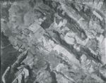
1937 Santa Cruz County and Monterey County Flight 13-ABG 5-9
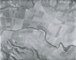 Creator:Type:Place:Date Created:[1937]Subject:Pajaro River and Watsonville
 -
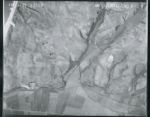
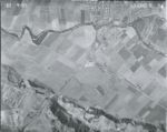
1937 Santa Cruz County and Monterey County Flight 13-ABG 5-8
 Creator:Type:Place:Date Created:[1937]Subject:Pacific Ocean, Pajaro River, and Watsonville
 -
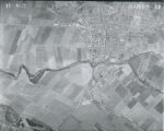
1937 Santa Cruz County and Monterey County Flight 13-ABG 5-7
 Creator:Type:Place:Date Created:[1937]Subject:Sunset State Beach and Watsonville
 -
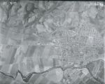
1937 Santa Cruz County and Monterey County Flight 13-ABG 5-60
 Creator:Type:Place:Date Created:[1937]Subject:Watsonville
 -
1937 Santa Cruz County and Monterey County Flight 13-ABG 5-59
 Creator:Type:Place:Date Created:[1937]Subject:Watsonville
 -
1937 Santa Cruz County and Monterey County Flight 13-ABG 5-58
 Creator:Type:Place:Date Created:[1937]Subject:Watsonville
 -
1937 Santa Cruz County and Monterey County Flight 13-ABG 5-56
 Creator:Type:Place:Date Created:[1937]Subject:Watsonville
 -
1937 Santa Cruz County and Monterey County Flight 13-ABG 5-57
 Creator:Type:Place:Date Created:[1937]Subject:Watsonville
 -
1937 Santa Cruz County and Monterey County Flight 13-ABG 5-54
 Creator:Type:Place:Date Created:[1937]Subject:Pajaro River, Pajaro Valley, and Watsonville
 -
1937 Santa Cruz County and Monterey County Flight 13-ABG 5-53
 Creator:Type:Place:Date Created:[1937]Subject:Pajaro River and Watsonville
 -
1937 Santa Cruz County and Monterey County Flight 13-ABG 5-52
 Creator:Type:Place:Date Created:[1937]Subject:Pajaro River and Watsonville
 -
1937 Santa Cruz County and Monterey County Flight 13-ABG 5-51
 Creator:Type:Place:Date Created:[1937]Subject:Watsonville
Limit your search
- Collection372
- Image68
- Sound20
- Santa Cruz County History Collections362
- Santa Cruz County historic photograph collection358
- UC Santa Cruz Aerial Photographs Collection58
- 1939-A Santa Cruz County Flight CJA27
- Cabrillo Music Festival of Contemporary Music Recordings Collection20
- UC Santa Cruz Campus History Collections20
- 1937 Santa Cruz County and Monterey County Flight 13-ABG16
- UCSC Photography Services Photographs11
- 1976 Cabrillo Music Festival: Concert 99
- Carol Foote photographs of the University of California, Santa Cruz9
- 1980 Cabrillo Music Festival: Concert 115
- Vester and Esther Dick Papers4
- more Collections »