Skip to Content
Toggle navigation
UC Santa Cruz
University Library
Contact Us
Browse Collections
Digital Collections
Photographs, audio recordings, publications, and more from our Special Collections & Archives
Search
Search
Search Constraints
Start Over
Filtering by:
Collection
1966-D San Andreas Fault Zone Flight
Remove constraint Collection: 1966-D San Andreas Fault Zone Flight
Sort by relevance
relevance
Title ▼
Title ▲
Date Created ▼
Date Created ▲
Number of results to display per page
24 per page
10
per page
20
per page
24
per page
50
per page
100
per page
View results as:
List
Gallery
Masonry
Search Results
1238 results for:
1966-D San Andreas Fault Zone Flight 2554-WRD
Title:
1966-D San Andreas Fault Zone Flight 2554-WRD
Creator:
Pacific Western Aerial Surveys
Type:
Image
Date Created:
[1966]
Description:
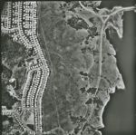
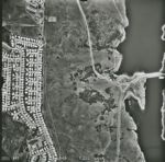
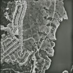
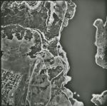
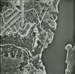
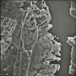
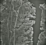
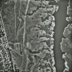
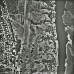
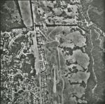
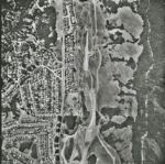
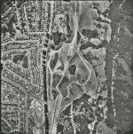
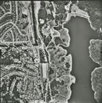
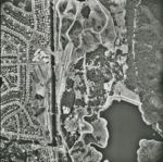
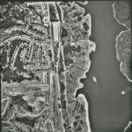
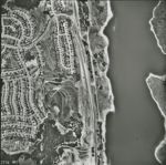
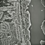
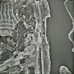
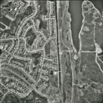
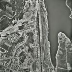
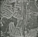
San Andreas Fault Zone, from San Francisco County line to Monterey County- San Luis Obispo County line. Flight has a total of approximately 8500 images
1966-D San Andreas Fault Zone Flight 2555-WRD
Title:
1966-D San Andreas Fault Zone Flight 2555-WRD
Creator:
Pacific Western Aerial Surveys
Type:
Image
Date Created:
[1966]
Description:
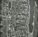
San Andreas Fault Zone, from San Francisco County line to Monterey County- San Luis Obispo County line. Flight has a total of approximately 8500 images
1966-D San Andreas Fault Zone Flight 2553-WRD
Title:
1966-D San Andreas Fault Zone Flight 2553-WRD
Creator:
Pacific Western Aerial Surveys
Type:
Image
Date Created:
[1966]
Description:
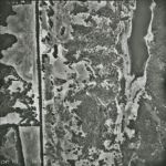
San Andreas Fault Zone, from San Francisco County line to Monterey County- San Luis Obispo County line. Flight has a total of approximately 8500 images
1966-D San Andreas Fault Zone Flight 2551-WRD
Title:
1966-D San Andreas Fault Zone Flight 2551-WRD
Creator:
Pacific Western Aerial Surveys
Type:
Image
Date Created:
[1966]
Description:
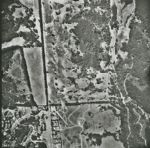
San Andreas Fault Zone, from San Francisco County line to Monterey County- San Luis Obispo County line. Flight has a total of approximately 8500 images
1966-D San Andreas Fault Zone Flight 2552-WRD
Title:
1966-D San Andreas Fault Zone Flight 2552-WRD
Creator:
Pacific Western Aerial Surveys
Type:
Image
Date Created:
[1966]
Description:
San Andreas Fault Zone, from San Francisco County line to Monterey County- San Luis Obispo County line. Flight has a total of approximately 8500 images
1966-D San Andreas Fault Zone Flight 2550-WRD
Title:
1966-D San Andreas Fault Zone Flight 2550-WRD
Creator:
Pacific Western Aerial Surveys
Type:
Image
Date Created:
[1966]
Description:
San Andreas Fault Zone, from San Francisco County line to Monterey County- San Luis Obispo County line. Flight has a total of approximately 8500 images
1966-D San Andreas Fault Zone Flight 2549-WRD
Title:
1966-D San Andreas Fault Zone Flight 2549-WRD
Creator:
Pacific Western Aerial Surveys
Type:
Image
Date Created:
[1966]
Description:
San Andreas Fault Zone, from San Francisco County line to Monterey County- San Luis Obispo County line. Flight has a total of approximately 8500 images
1966-D San Andreas Fault Zone Flight 2548-WRD
Title:
1966-D San Andreas Fault Zone Flight 2548-WRD
Creator:
Pacific Western Aerial Surveys
Type:
Image
Date Created:
[1966]
Description:
San Andreas Fault Zone, from San Francisco County line to Monterey County- San Luis Obispo County line. Flight has a total of approximately 8500 images
1966-D San Andreas Fault Zone Flight 2547-WRD
Title:
1966-D San Andreas Fault Zone Flight 2547-WRD
Creator:
Pacific Western Aerial Surveys
Type:
Image
Date Created:
[1966]
Description:
San Andreas Fault Zone, from San Francisco County line to Monterey County- San Luis Obispo County line. Flight has a total of approximately 8500 images
1966-D San Andreas Fault Zone Flight 2546-WRD
Title:
1966-D San Andreas Fault Zone Flight 2546-WRD
Creator:
Pacific Western Aerial Surveys
Type:
Image
Date Created:
[1966]
Description:
San Andreas Fault Zone, from San Francisco County line to Monterey County- San Luis Obispo County line. Flight has a total of approximately 8500 images
1966-D San Andreas Fault Zone Flight 2545-WRD
Title:
1966-D San Andreas Fault Zone Flight 2545-WRD
Creator:
Pacific Western Aerial Surveys
Type:
Image
Date Created:
[1966]
Description:
San Andreas Fault Zone, from San Francisco County line to Monterey County- San Luis Obispo County line. Flight has a total of approximately 8500 images
1966-D San Andreas Fault Zone Flight 2544-WRD
Title:
1966-D San Andreas Fault Zone Flight 2544-WRD
Creator:
Pacific Western Aerial Surveys
Type:
Image
Date Created:
[1966]
Description:
San Andreas Fault Zone, from San Francisco County line to Monterey County- San Luis Obispo County line. Flight has a total of approximately 8500 images
1966-D San Andreas Fault Zone Flight 2543-WRD
Title:
1966-D San Andreas Fault Zone Flight 2543-WRD
Creator:
Pacific Western Aerial Surveys
Type:
Image
Date Created:
[1966]
Description:
San Andreas Fault Zone, from San Francisco County line to Monterey County- San Luis Obispo County line. Flight has a total of approximately 8500 images
1966-D San Andreas Fault Zone Flight 2542-WRD
Title:
1966-D San Andreas Fault Zone Flight 2542-WRD
Creator:
Pacific Western Aerial Surveys
Type:
Image
Date Created:
[1966]
Description:
San Andreas Fault Zone, from San Francisco County line to Monterey County- San Luis Obispo County line. Flight has a total of approximately 8500 images
1966-D San Andreas Fault Zone Flight 2541-WRD
Title:
1966-D San Andreas Fault Zone Flight 2541-WRD
Creator:
Pacific Western Aerial Surveys
Type:
Image
Date Created:
[1966]
Description:
San Andreas Fault Zone, from San Francisco County line to Monterey County- San Luis Obispo County line. Flight has a total of approximately 8500 images
1966-D San Andreas Fault Zone Flight 2539-WRD
Title:
1966-D San Andreas Fault Zone Flight 2539-WRD
Creator:
Pacific Western Aerial Surveys
Type:
Image
Date Created:
[1966]
Description:
San Andreas Fault Zone, from San Francisco County line to Monterey County- San Luis Obispo County line. Flight has a total of approximately 8500 images
1966-D San Andreas Fault Zone Flight 2540-WRD
Title:
1966-D San Andreas Fault Zone Flight 2540-WRD
Creator:
Pacific Western Aerial Surveys
Type:
Image
Date Created:
[1966]
Description:
San Andreas Fault Zone, from San Francisco County line to Monterey County- San Luis Obispo County line. Flight has a total of approximately 8500 images
1966-D San Andreas Fault Zone Flight 2538-WRD
Title:
1966-D San Andreas Fault Zone Flight 2538-WRD
Creator:
Pacific Western Aerial Surveys
Type:
Image
Date Created:
[1966]
Description:
San Andreas Fault Zone, from San Francisco County line to Monterey County- San Luis Obispo County line. Flight has a total of approximately 8500 images
1966-D San Andreas Fault Zone Flight 2536-WRD
Title:
1966-D San Andreas Fault Zone Flight 2536-WRD
Creator:
Pacific Western Aerial Surveys
Type:
Image
Date Created:
[1966]
Description:
San Andreas Fault Zone, from San Francisco County line to Monterey County- San Luis Obispo County line. Flight has a total of approximately 8500 images
1966-D San Andreas Fault Zone Flight 2537-WRD
Title:
1966-D San Andreas Fault Zone Flight 2537-WRD
Creator:
Pacific Western Aerial Surveys
Type:
Image
Date Created:
[1966]
Description:
San Andreas Fault Zone, from San Francisco County line to Monterey County- San Luis Obispo County line. Flight has a total of approximately 8500 images
1966-D San Andreas Fault Zone Flight 2535-WRD
Title:
1966-D San Andreas Fault Zone Flight 2535-WRD
Creator:
Pacific Western Aerial Surveys
Type:
Image
Date Created:
[1966]
Description:
San Andreas Fault Zone, from San Francisco County line to Monterey County- San Luis Obispo County line. Flight has a total of approximately 8500 images
1966-D San Andreas Fault Zone Flight 2533-WRD
Title:
1966-D San Andreas Fault Zone Flight 2533-WRD
Creator:
Pacific Western Aerial Surveys
Type:
Image
Date Created:
[1966]
Description:
San Andreas Fault Zone, from San Francisco County line to Monterey County- San Luis Obispo County line. Flight has a total of approximately 8500 images
1966-D San Andreas Fault Zone Flight 2534-WRD
Title:
1966-D San Andreas Fault Zone Flight 2534-WRD
Creator:
Pacific Western Aerial Surveys
Type:
Image
Date Created:
[1966]
Description:
San Andreas Fault Zone, from San Francisco County line to Monterey County- San Luis Obispo County line. Flight has a total of approximately 8500 images
1966-D San Andreas Fault Zone Flight 2532-WRD
Title:
1966-D San Andreas Fault Zone Flight 2532-WRD
Creator:
Pacific Western Aerial Surveys
Type:
Image
Date Created:
[1966]
Description:
San Andreas Fault Zone, from San Francisco County line to Monterey County- San Luis Obispo County line. Flight has a total of approximately 8500 images
Previous
1
2
…
8
9
10
11
12
13
14
15
16
…
51
52
Next
Show Filters
Limit your search
Creator
Pacific Western Aerial Surveys
988
Type
Image
1,238
Collection
1966-D San Andreas Fault Zone Flight
[remove]
1,238
UC Santa Cruz Aerial Photographs Collection
1,238
×
Digital Collections Feedback