Search Constraints
Number of results to display per page
Search Results
20073 results for:
-
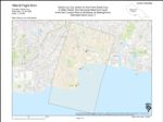
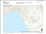
1963-C Santa Cruz Small Craft Harbor Flight SC
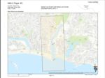 Variant Title:Type:Place:Date Created:1963Description:Subject:Santa Cruz County, Santa Cruz, and Santa Cruz Small Craft HarborCall Number:1963-C
 -
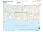
1963-B Santa Cruz City Flight SC
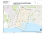 Variant Title:Type:Place:Date Created:1963Subject:Santa Cruz County, Santa Cruz, San Lorenzo River Mouth, and Lighthouse FieldCall Number:1963-B
 -
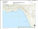
1963-A Santa Cruz County Flight SC
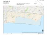 Type:Place:Topic:Date Created:1963Description:Subject:Coasts--California, Santa Cruz County, Soquel Point, Capitola, Santa Cruz, Santa Cruz Small Craft Harbor, San Lorenzo River Mouth, Live Oak, and Lighthouse FieldCall Number:1963-A
 -
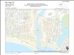
1962-C Santa Cruz County Flight SCH
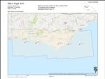 Type:Place:Topic:Date Created:1962Description:Subject:Coasts--California, Santa Cruz County, Soquel Point, Capitola, Santa Cruz, Santa Cruz Small Craft Harbor, and Live OakCall Number:1962-C
 -
1962-B Santa Cruz City Flight SCH
 Type:Place:Date Created:1962Subject:Santa CruzCall Number:1962-B
 -
1962-A Santa Cruz Small Craft Harbor Flight SCH
 Variant Title:Type:Place:Date Created:1962Subject:Santa Cruz County, Santa Cruz, and Santa Cruz Small Craft HarborCall Number:1962-A
 -
1961-B Santa Cruz County Flight SC
 Variant Title:Type:Place:Topic:Date Created:1961Description:Subject:Coasts--California, Santa Cruz County, Wilder Ranch State Park, Capitola, Pajaro Valley, Santa Cruz, Santa Cruz Small Craft Harbor, Antonelli Pond, Live Oak, Natural Bridges State Beach, La Selva Beach, Aptos, Lighthouse Field, and Soquel PointCall Number:1961-B
 -
1961 Santa Cruz County Flight SC
 Variant Title:Type:Place:Date Created:1961Description:Subject:Santa CruzCall Number:1961
 -
1956-B Santa Cruz County Flight CJA
 Variant Title:Creator:Type:Place:Santa Cruz County, Ben Lomond, Watsonville Municipal Airport, Capitola, Felton, Santa Cruz, Santa Clara, San Benito, Point Año Nuevo, The Forest of Nisene Marks State Park, University of California Santa Cruz, San Lorenzo River Mouth, Antonelli Pond, San Lorenzo Valley, Elkhorn Slough, Pogonip, San Mateo, Greyhound Rock, Natural Bridges State Beach, La Selva Beach, Watsonville, Corralitos, Scotts Valley, Lighthouse Field, Monterey County, Wilder Ranch State Park, Soquel Point, Big Basin Redwoods State Park, Pajaro Valley, Boulder Creek, Waddell Creek Beach, Santa Cruz Small Craft Harbor, Live Oak, and AptosDate Created:1956Subject:Santa Cruz County, Ben Lomond, Watsonville Municipal Airport, Capitola, Felton, Santa Cruz, Santa Clara, San Benito, Point Año Nuevo, The Forest of Nisene Marks State Park, University of California Santa Cruz, San Lorenzo River Mouth, Antonelli Pond, San Lorenzo Valley, Elkhorn Slough, Pogonip, San Mateo, Greyhound Rock, Natural Bridges State Beach, La Selva Beach, Watsonville, Corralitos, Scotts Valley, Lighthouse Field, Monterey County, Wilder Ranch State Park, Soquel Point, Big Basin Redwoods State Park, Pajaro Valley, Boulder Creek, Waddell Creek Beach, Santa Cruz Small Craft Harbor, Live Oak, and AptosCall Number:1956-B
 -
1956-A Soquel Creek and Vicinity Flight SR
 Variant Title:Type:Place:Date Created:[1956]Subject:Santa Cruz County, Capitola, Santa Cruz, and SoquelCall Number:1956-A
 -
1953 Santa Cruz County Flight CCL
 Type:Place:Topic:Date Created:[1953]Subject:Coasts--California, Santa Cruz County, Wilder Ranch State Park, Capitola, Pajaro Valley, Santa Cruz, Santa Cruz Small Craft Harbor, San Lorenzo River Mouth, Live Oak, San Mateo, Greyhound Rock, Natural Bridges State Beach, La Selva Beach, Aptos, Lighthouse Field, and Soquel PointCall Number:1953
 -
1948 U.S. Forest Service Flight CDF-5
 Variant Title:Creator:Type:Place:Monterey County, Ben Lomond, Los Gatos, Big Basin Redwoods State Park, Capitola, Pajaro Valley, Santa Cruz, Palo Alto, Santa Cruz Small Craft Harbor, The Forest of Nisene Marks State Park, University of California Santa Cruz, San Lorenzo River Mouth, Antonelli Pond, San Lorenzo Valley, Live Oak, Pogonip, San Mateo, Greyhound Rock, Natural Bridges State Beach, La Selva Beach, Watsonville, Aptos, Almaden Canyon, Scotts Valley, Lighthouse Field, Santa Cruz County, Watsonville Municipal Airport, Wilder Ranch State Park, Soquel Point, Felton, Boulder Creek, Santa Clara, Waddell Creek Beach, Point Año Nuevo, Pescadero, and CorralitosDate Created:1948Description:Subject:Monterey County, Ben Lomond, Los Gatos, Big Basin Redwoods State Park, Capitola, Pajaro Valley, Santa Cruz, Palo Alto, Santa Cruz Small Craft Harbor, The Forest of Nisene Marks State Park, University of California Santa Cruz, San Lorenzo River Mouth, Antonelli Pond, San Lorenzo Valley, Live Oak, Pogonip, San Mateo, Greyhound Rock, Natural Bridges State Beach, La Selva Beach, Watsonville, Aptos, Almaden Canyon, Scotts Valley, Lighthouse Field, Santa Cruz County, Watsonville Municipal Airport, Wilder Ranch State Park, Soquel Point, Felton, Boulder Creek, Santa Clara, Waddell Creek Beach, Point Año Nuevo, Pescadero, and CorralitosCall Number:1948
 -
1943 Santa Cruz County Flight CJA
 Variant Title:Creator:Type:Place:Santa Cruz County, Ben Lomond, Big Basin Redwoods State Park, Capitola, Boulder Creek, Santa Cruz, Santa Cruz Small Craft Harbor, University of California Santa Cruz, San Lorenzo River Mouth, San Lorenzo Valley, Live Oak, Pogonip, Greyhound Rock, Natural Bridges State Beach, Scotts Valley, Lighthouse Field, Soquel Point, Felton, and Waddell Creek BeachDate Created:1943Subject:Santa Cruz County, Ben Lomond, Big Basin Redwoods State Park, Capitola, Boulder Creek, Santa Cruz, Santa Cruz Small Craft Harbor, University of California Santa Cruz, San Lorenzo River Mouth, San Lorenzo Valley, Live Oak, Pogonip, Greyhound Rock, Natural Bridges State Beach, Scotts Valley, Lighthouse Field, Soquel Point, Felton, and Waddell Creek BeachCall Number:1943
 -
1941 City of Santa Cruz and Vicinity Flight C-7054
 Variant Title:Creator:Type:Place:Date Created:[1941]Subject:University of California, Santa Cruz, Santa Cruz County, Santa Cruz, Waddell Creek Beach, University of California Santa Cruz, San Lorenzo River Mouth, Antonelli Pond, Bonny Doon, Live Oak, Davenport, Pogonip, Greyhound Rock, Natural Bridges State Beach, Swanton, and Santa Cruz Small Craft HarborCall Number:1941
 -
1940-A Santa Cruz County Flight SLR
 Variant Title:Type:Place:Date Created:[1940]Subject:Lighthouse Field, Ben Lomond, Boulder Creek, Santa Cruz, San Lorenzo River, University of California Santa Cruz, San Lorenzo River Mouth, San Lorenzo Valley, Pogonip, Scotts Valley, Santa Cruz County, and FeltonCall Number:1940-A
 -
1940 Santa Cruz County Flight C-6472
 Creator:Type:Place:Date Created:[1940]Subject:Lighthouse Field, Wilder Ranch State Park, Felton, Santa Cruz, Santa Cruz Small Craft Harbor, University of California Santa Cruz, San Lorenzo River Mouth, Antonelli Pond, San Lorenzo Valley, Live Oak, Pogonip, Natural Bridges State Beach, Scotts Valley, Santa Cruz County, and Soquel PointCall Number:1940
 -
1931-C Santa Cruz County Flight C-1437
 Variant Title:Creator:Type:Place:Date Created:[1931]Subject:Santa Cruz County, Santa Cruz, and San Lorenzo River MouthCall Number:1931-C
 -
1931-B Santa Cruz County Flight C-1437
 Creator:Type:Place:Date Created:[1931]Subject:Lighthouse Field, Soquel Point, Capitola, Pajaro Valley, Santa Cruz, Santa Cruz Small Craft Harbor, The Forest of Nisene Marks State Park, University of California Santa Cruz, San Lorenzo River Mouth, Live Oak, Pogonip, Natural Bridges State Beach, Santa Cruz County, and Wilder Ranch State ParkCall Number:1931-B
 -
1931-A Santa Cruz County Flight C-1437
 Creator:Type:Place:Date Created:[1931]Subject:Santa Cruz County, Felton, Santa Cruz, University of California Santa Cruz, San Lorenzo River Mouth, San Lorenzo Valley, and PogonipCall Number:1931-A
 -
1928-H California Coastline Flight
 Creator:Type:Place:Topic:Date Created:[1928]Subject:Coasts--California, Santa Cruz County, Soquel Point, Capitola, Santa Cruz, Santa Cruz Small Craft Harbor, San Lorenzo River Mouth, Live Oak, La Selva Beach, Aptos, Lighthouse Field, and CorralitosCall Number:1928-H
 -
1928-F California Coastline Flight
 Creator:Type:Place:Topic:Date Created:[1928]Subject:Coasts--California, Santa Cruz County, Pajaro Valley, Santa Cruz, San Lorenzo River Mouth, La Selva Beach, and AptosCall Number:1928-F
 -
Loma Prieta Earthquake. Burned house on Myrtle Street, Santa Cruz, California
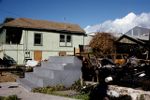 Creator:Type:Place:Topic:Date Created:1989-10-17Description:Subject:Earthquakes--California, Loma Prieta Earthquake, Calif., 1989, Natural disasters, Housing, and Santa CruzCall Number:MS 235
 -
Loma Prieta Earthquake. Cooper House, (formerly Santa Cruz County Courthouse #5, 110 Cooper Street) building damage, Santa Cruz, California
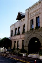 Creator:Type:Place:Date Created:1989-10-17Description:Subject:Earthquakes--California, Loma Prieta Earthquake, Calif., 1989, Natural disasters, and Santa CruzCall Number:MS 235
 -
Loma Prieta Earthquake. Building damage on Pacific Avenue, Santa Cruz, California
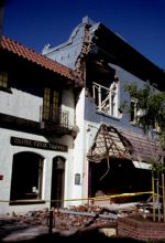 Creator:Type:Place:Date Created:1989-10-17Description:Subject:Earthquakes--California, Loma Prieta Earthquake, Calif., 1989, Natural disasters, and Santa CruzCall Number:MS 235
Limit your search
- Image13,558
- Collection6,407
- Sound103
- Text2
- Santa Cruz[remove]20,073
- University of California Santa Cruz12,194
- University House684
- Upper Quarry Amphitheater557
- McHenry Library439
- more Places »
- UC Santa Cruz Campus History Collections13,144
- UCSC Photography Services Photographs12,166
- Santa Cruz County History Collections6,525
- Santa Cruz County historic photograph collection6,356
- University of California, Santa Cruz, Public Information Office records398
- Carol Foote photographs of the University of California, Santa Cruz285
- Frank Zwart papers266
- Harry Mayo Surfing Photography Collection198
- Cabrillo Music Festival of Contemporary Music Recordings Collection103
- Chuck and Esther Abbott Slide Collection100
- Shakespeare Santa Cruz records60
- UC Santa Cruz Aerial Photographs Collection45
- more Collections »