Search Constraints
Filtering by:
Place
Live Oak
Remove constraint Place: Live Oak
Place
Santa Cruz
Remove constraint Place: Santa Cruz
Place
Santa Cruz County
Remove constraint Place: Santa Cruz County
Number of results to display per page
Search Results
22 results for:
-
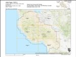
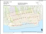
1969-A Santa Cruz City and County Urban Area Flight SC
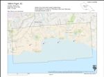 Type:Place:Topic:Date Created:[1969]Description:Subject:Coasts--California, Santa Cruz County, Santa Cruz, and Live OakCall Number:1969-A
 -
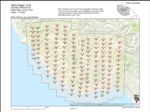
1967-M San Mateo and Santa Cruz Counties Flight CCL 2
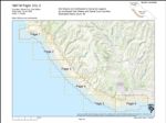 Variant Title:Type:Place:Topic:Date Created:[1967]Description:Subject:Coasts--California, Waddell Creek, Wilder Ranch State Park, Santa Cruz, Santa Cruz Small Craft Harbor, San Lorenzo River Mouth, Antonelli Pond, Live Oak, San Mateo, Año Nuevo State Park, Greyhound Rock, Natural Bridges State Beach, Lighthouse Field, and Santa Cruz CountyCall Number:1967-M
 -
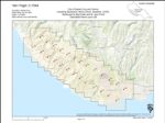
1967-E California Coastline
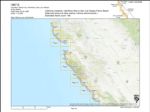 Title:Variant Title:Type:Place:Waddell Creek, San Luis Obispo, Wilder Ranch State Park, Capitola, Pajaro Valley, Los Padres National Forest, Santa Cruz, Santa Cruz Small Craft Harbor, Half Moon Bay, San Lorenzo River Mouth, Antonelli Pond, Live Oak, Pillar Point, San Mateo, Big Sur, Monterey, Pescadero, Monterey County, Santa Cruz County, Soquel Point, Montara State Beach, Elkhorn Slough, Greyhound Rock, and Natural Bridges State BeachTopic:Date Created:1967Subject:Coasts--California, Kelp bed ecology, Marine ecology, Waddell Creek, San Luis Obispo, Wilder Ranch State Park, Capitola, Pajaro Valley, Los Padres National Forest, Santa Cruz, Santa Cruz Small Craft Harbor, Half Moon Bay, San Lorenzo River Mouth, Antonelli Pond, Live Oak, Pillar Point, San Mateo, Big Sur, Monterey, Pescadero, Monterey County, Santa Cruz County, Soquel Point, Montara State Beach, Elkhorn Slough, Greyhound Rock, and Natural Bridges State BeachCall Number:1967-E
 -
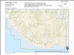
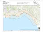
1970 California Coastline Flight
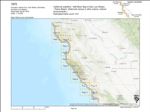 Variant Title:Type:Place:Santa Cruz County, San Luis Obispo, Soquel Point, Carmel Valley, Pajaro Valley, Los Padres National Forest, Santa Cruz, Santa Cruz Small Craft Harbor, Half Moon Bay, San Lorenzo River Mouth, Antonelli Pond, Elkhorn Slough, Pillar Point, San Mateo, Año Nuevo State Park, Big Sur, Monterey, La Selva Beach, Aptos, Lighthouse Field, Monterey County, Waddell Creek, Capitola, Marina, Live Oak, Greyhound Rock, Natural Bridges State Beach, and PescaderoTopic:Date Created:[1970]Subject:Coasts--California, Kelp bed ecology, Marine ecology, Santa Cruz County, San Luis Obispo, Soquel Point, Carmel Valley, Pajaro Valley, Los Padres National Forest, Santa Cruz, Santa Cruz Small Craft Harbor, Half Moon Bay, San Lorenzo River Mouth, Antonelli Pond, Elkhorn Slough, Pillar Point, San Mateo, Año Nuevo State Park, Big Sur, Monterey, La Selva Beach, Aptos, Lighthouse Field, Monterey County, Waddell Creek, Capitola, Marina, Live Oak, Greyhound Rock, Natural Bridges State Beach, and Pescadero
 -
1965-J Santa Cruz County Coastline Flight SC-1
 Creator:Type:Place:Topic:Date Created:[1965]Subject:Coasts--California, Santa Cruz County, Soquel Point, Capitola, Santa Cruz, Santa Cruz Small Craft Harbor, San Lorenzo River Mouth, Antonelli Pond, Live Oak, Natural Bridges State Beach, La Selva Beach, Aptos, and Lighthouse FieldCall Number:1965-J
 -
1965-F Santa Cruz County Coastline Flight SC
 Variant Title:Type:Place:Topic:Date Created:[1965]Subject:Coasts--California, Santa Cruz County, Soquel Point, Capitola, Santa Cruz, Santa Cruz Small Craft Harbor, San Lorenzo River Mouth, Live Oak, and Lighthouse FieldCall Number:1965-F
 -
1965-B Santa Cruz County Coastline Flight SC
 Variant Title:Type:Place:Topic:Date Created:[1965]Subject:Coasts--California, Santa Cruz County, Santa Cruz, Santa Cruz Small Craft Harbor, San Lorenzo River Mouth, and Live OakCall Number:1965-B
 -
1964-A Twin Lakes Drainage Area
 Variant Title:Type:Place:Date Created:[1964]Subject:Santa Cruz County, Santa Cruz, Santa Cruz Small Craft Harbor, and Live OakCall Number:1964-A
 -
1963-F Santa Cruz Coastline Flight SC
 Type:Place:Topic:Date Created:1963Subject:Coasts--California, Santa Cruz County, Soquel Point, Santa Cruz, Santa Cruz Small Craft Harbor, San Lorenzo River Mouth, and Live OakCall Number:1963-F
 -
1963-E Santa Cruz County Flight CJA
 Variant Title:Type:Place:Santa Cruz County, Ben Lomond, Watsonville Municipal Airport, Capitola, Felton, Santa Cruz, Santa Clara, Santa Cruz Small Craft Harbor, The Forest of Nisene Marks State Park, University of California Santa Cruz, San Lorenzo River Mouth, San Lorenzo Valley, Live Oak, Pogonip, San Mateo, Greyhound Rock, Natural Bridges State Beach, La Selva Beach, Watsonville, Corralitos, Scotts Valley, Lighthouse Field, Monterey County, Waddell Creek, Wilder Ranch State Park, Soquel Point, Big Basin Redwoods State Park, Pajaro Valley, Boulder Creek, and AptosDate Created:1963Subject:Santa Cruz County, Ben Lomond, Watsonville Municipal Airport, Capitola, Felton, Santa Cruz, Santa Clara, Santa Cruz Small Craft Harbor, The Forest of Nisene Marks State Park, University of California Santa Cruz, San Lorenzo River Mouth, San Lorenzo Valley, Live Oak, Pogonip, San Mateo, Greyhound Rock, Natural Bridges State Beach, La Selva Beach, Watsonville, Corralitos, Scotts Valley, Lighthouse Field, Monterey County, Waddell Creek, Wilder Ranch State Park, Soquel Point, Big Basin Redwoods State Park, Pajaro Valley, Boulder Creek, and AptosCall Number:1963-E
 -
1963-D Santa Cruz Coastline Flight SC
 Type:Place:Topic:Date Created:1963Subject:Coasts--California, Santa Cruz County, Santa Cruz, Santa Cruz Small Craft Harbor, San Lorenzo River Mouth, and Live OakCall Number:1963-D
 -
1963-A Santa Cruz County Flight SC
 Type:Place:Topic:Date Created:1963Description:Subject:Coasts--California, Santa Cruz County, Soquel Point, Capitola, Santa Cruz, Santa Cruz Small Craft Harbor, San Lorenzo River Mouth, Live Oak, and Lighthouse FieldCall Number:1963-A
 -
1962-C Santa Cruz County Flight SCH
 Type:Place:Topic:Date Created:1962Description:Subject:Coasts--California, Santa Cruz County, Soquel Point, Capitola, Santa Cruz, Santa Cruz Small Craft Harbor, and Live OakCall Number:1962-C
 -
1961-B Santa Cruz County Flight SC
 Variant Title:Type:Place:Topic:Date Created:1961Description:Subject:Coasts--California, Santa Cruz County, Wilder Ranch State Park, Capitola, Pajaro Valley, Santa Cruz, Santa Cruz Small Craft Harbor, Antonelli Pond, Live Oak, Natural Bridges State Beach, La Selva Beach, Aptos, Lighthouse Field, and Soquel PointCall Number:1961-B
 -
1956-B Santa Cruz County Flight CJA
 Variant Title:Creator:Type:Place:Santa Cruz County, Ben Lomond, Watsonville Municipal Airport, Capitola, Felton, Santa Cruz, Santa Clara, San Benito, Point Año Nuevo, The Forest of Nisene Marks State Park, University of California Santa Cruz, San Lorenzo River Mouth, Antonelli Pond, San Lorenzo Valley, Elkhorn Slough, Pogonip, San Mateo, Greyhound Rock, Natural Bridges State Beach, La Selva Beach, Watsonville, Corralitos, Scotts Valley, Lighthouse Field, Monterey County, Wilder Ranch State Park, Soquel Point, Big Basin Redwoods State Park, Pajaro Valley, Boulder Creek, Waddell Creek Beach, Santa Cruz Small Craft Harbor, Live Oak, and AptosDate Created:1956Subject:Santa Cruz County, Ben Lomond, Watsonville Municipal Airport, Capitola, Felton, Santa Cruz, Santa Clara, San Benito, Point Año Nuevo, The Forest of Nisene Marks State Park, University of California Santa Cruz, San Lorenzo River Mouth, Antonelli Pond, San Lorenzo Valley, Elkhorn Slough, Pogonip, San Mateo, Greyhound Rock, Natural Bridges State Beach, La Selva Beach, Watsonville, Corralitos, Scotts Valley, Lighthouse Field, Monterey County, Wilder Ranch State Park, Soquel Point, Big Basin Redwoods State Park, Pajaro Valley, Boulder Creek, Waddell Creek Beach, Santa Cruz Small Craft Harbor, Live Oak, and AptosCall Number:1956-B
 -
1953 Santa Cruz County Flight CCL
 Type:Place:Topic:Date Created:[1953]Subject:Coasts--California, Santa Cruz County, Wilder Ranch State Park, Capitola, Pajaro Valley, Santa Cruz, Santa Cruz Small Craft Harbor, San Lorenzo River Mouth, Live Oak, San Mateo, Greyhound Rock, Natural Bridges State Beach, La Selva Beach, Aptos, Lighthouse Field, and Soquel PointCall Number:1953
 -
1948 U.S. Forest Service Flight CDF-5
 Variant Title:Creator:Type:Place:Monterey County, Ben Lomond, Los Gatos, Big Basin Redwoods State Park, Capitola, Pajaro Valley, Santa Cruz, Palo Alto, Santa Cruz Small Craft Harbor, The Forest of Nisene Marks State Park, University of California Santa Cruz, San Lorenzo River Mouth, Antonelli Pond, San Lorenzo Valley, Live Oak, Pogonip, San Mateo, Greyhound Rock, Natural Bridges State Beach, La Selva Beach, Watsonville, Aptos, Almaden Canyon, Scotts Valley, Lighthouse Field, Santa Cruz County, Watsonville Municipal Airport, Wilder Ranch State Park, Soquel Point, Felton, Boulder Creek, Santa Clara, Waddell Creek Beach, Point Año Nuevo, Pescadero, and CorralitosDate Created:1948Description:Subject:Monterey County, Ben Lomond, Los Gatos, Big Basin Redwoods State Park, Capitola, Pajaro Valley, Santa Cruz, Palo Alto, Santa Cruz Small Craft Harbor, The Forest of Nisene Marks State Park, University of California Santa Cruz, San Lorenzo River Mouth, Antonelli Pond, San Lorenzo Valley, Live Oak, Pogonip, San Mateo, Greyhound Rock, Natural Bridges State Beach, La Selva Beach, Watsonville, Aptos, Almaden Canyon, Scotts Valley, Lighthouse Field, Santa Cruz County, Watsonville Municipal Airport, Wilder Ranch State Park, Soquel Point, Felton, Boulder Creek, Santa Clara, Waddell Creek Beach, Point Año Nuevo, Pescadero, and CorralitosCall Number:1948
 -
1943 Santa Cruz County Flight CJA
 Variant Title:Creator:Type:Place:Santa Cruz County, Ben Lomond, Big Basin Redwoods State Park, Capitola, Boulder Creek, Santa Cruz, Santa Cruz Small Craft Harbor, University of California Santa Cruz, San Lorenzo River Mouth, San Lorenzo Valley, Live Oak, Pogonip, Greyhound Rock, Natural Bridges State Beach, Scotts Valley, Lighthouse Field, Soquel Point, Felton, and Waddell Creek BeachDate Created:1943Subject:Santa Cruz County, Ben Lomond, Big Basin Redwoods State Park, Capitola, Boulder Creek, Santa Cruz, Santa Cruz Small Craft Harbor, University of California Santa Cruz, San Lorenzo River Mouth, San Lorenzo Valley, Live Oak, Pogonip, Greyhound Rock, Natural Bridges State Beach, Scotts Valley, Lighthouse Field, Soquel Point, Felton, and Waddell Creek BeachCall Number:1943
 -
1941 City of Santa Cruz and Vicinity Flight C-7054
 Variant Title:Creator:Type:Place:Date Created:[1941]Subject:University of California, Santa Cruz, Santa Cruz County, Santa Cruz, Waddell Creek Beach, University of California Santa Cruz, San Lorenzo River Mouth, Antonelli Pond, Bonny Doon, Live Oak, Davenport, Pogonip, Greyhound Rock, Natural Bridges State Beach, Swanton, and Santa Cruz Small Craft HarborCall Number:1941
 -
1940 Santa Cruz County Flight C-6472
 Creator:Type:Place:Date Created:[1940]Subject:Lighthouse Field, Wilder Ranch State Park, Felton, Santa Cruz, Santa Cruz Small Craft Harbor, University of California Santa Cruz, San Lorenzo River Mouth, Antonelli Pond, San Lorenzo Valley, Live Oak, Pogonip, Natural Bridges State Beach, Scotts Valley, Santa Cruz County, and Soquel PointCall Number:1940
 -
1931-B Santa Cruz County Flight C-1437
 Creator:Type:Place:Date Created:[1931]Subject:Lighthouse Field, Soquel Point, Capitola, Pajaro Valley, Santa Cruz, Santa Cruz Small Craft Harbor, The Forest of Nisene Marks State Park, University of California Santa Cruz, San Lorenzo River Mouth, Live Oak, Pogonip, Natural Bridges State Beach, Santa Cruz County, and Wilder Ranch State ParkCall Number:1931-B
 -
1928-H California Coastline Flight
 Creator:Type:Place:Topic:Date Created:[1928]Subject:Coasts--California, Santa Cruz County, Soquel Point, Capitola, Santa Cruz, Santa Cruz Small Craft Harbor, San Lorenzo River Mouth, Live Oak, La Selva Beach, Aptos, Lighthouse Field, and CorralitosCall Number:1928-H
Limit your search
- Live Oak[remove]22
- Santa Cruz[remove]22
- Santa Cruz County[remove]22
- Santa Cruz Small Craft Harbor21
- San Lorenzo River Mouth18
- more Places »