Search Constraints
Filtering by:
Collection
UC Santa Cruz Aerial Photographs Collection
Remove constraint Collection: UC Santa Cruz Aerial Photographs Collection
Creator
Aero Service Corporation
Remove constraint Creator: Aero Service Corporation
Number of results to display per page
Search Results
816 results for:
-
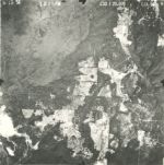
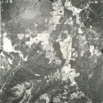
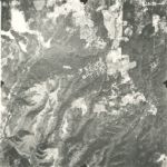
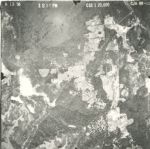
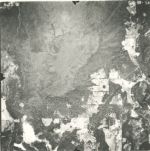
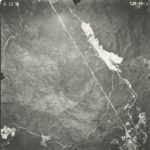
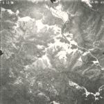
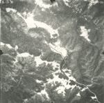
1956-C Monterey County Flight ABG: Part 2
 Variant Title:Creator:Place:King City, Fort Hunter Liggett, Carmel Valley, San Justo, Hollister Hills State Vehicular Recreation Area, Santa Clara, Soledad, Santa Cruz County, Marina, Greenfield, Fremont Peak State Park, Gonzales, Monterey, Monterey Regional Airport, Big Sur, Salinas, Monterey, Jolon, Pajaro Valley, Pinnacles National Park, San Benito, Fort Ord Military Reservation (historical), Elkhorn Slough, San Ardo, Los Padres National Forest, and CarmelDate Created:[1956]Description:Subject:King City, Fort Hunter Liggett, Carmel Valley, San Justo, Hollister Hills State Vehicular Recreation Area, Santa Clara, Soledad, Santa Cruz County, Marina, Greenfield, Fremont Peak State Park, Gonzales, Monterey, Monterey Regional Airport, Big Sur, Salinas, Monterey, Jolon, Pajaro Valley, Pinnacles National Park, San Benito, Fort Ord Military Reservation (historical), Elkhorn Slough, San Ardo, Los Padres National Forest, and CarmelCall Number:1956-C
 -
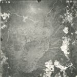
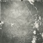
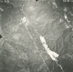
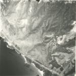
1956-C Monterey County Flight ABG: Part 1
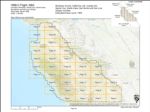 Variant Title:Creator:Place:King City, Fort Hunter Liggett, Carmel Valley, San Justo, Hollister Hills State Vehicular Recreation Area, Fort Ord Military Reservation (historical), Elkhorn Slough, San Ardo, Marina, Greenfield, Fremont Peak State Park, Gonzales, Monterey, Monterey Regional Airport, Carmel, Salinas, Monterey, Jolon, Pajaro Valley, Pinnacles National Park, San Benito, Santa Clara, Soledad, Santa Cruz County, Los Padres National Forest, and Big SurDate Created:[1956]Description:Subject:King City, Fort Hunter Liggett, Carmel Valley, San Justo, Hollister Hills State Vehicular Recreation Area, Fort Ord Military Reservation (historical), Elkhorn Slough, San Ardo, Marina, Greenfield, Fremont Peak State Park, Gonzales, Monterey, Monterey Regional Airport, Carmel, Salinas, Monterey, Jolon, Pajaro Valley, Pinnacles National Park, San Benito, Santa Clara, Soledad, Santa Cruz County, Los Padres National Forest, and Big SurCall Number:1956-C
Limit your search
- Image811
- Collection3
- UC Santa Cruz Aerial Photographs Collection[remove]816
- 1956-B Santa Cruz County Flight CJA362
- 1943-A San Mateo County Flight DDB292
- 1943 Santa Cruz County Flight CJA157