Skip to Content
Toggle navigation
UC Santa Cruz
University Library
Contact Us
Browse Collections
Digital Collections
Photographs, audio recordings, publications, and more from our Special Collections & Archives
Search
Search
Search Constraints
Start Over
Filtering by:
Collection
UC Santa Cruz Aerial Photographs Collection
Remove constraint Collection: UC Santa Cruz Aerial Photographs Collection
Sort by relevance
relevance
Title ▼
Title ▲
Date Created ▼
Date Created ▲
Number of results to display per page
24 per page
10
per page
20
per page
24
per page
50
per page
100
per page
View results as:
List
Gallery
Masonry
Search Results
11058 results for:
1966-D San Andreas Fault Zone Flight 0298B-WRD
Title:
1966-D San Andreas Fault Zone Flight 0298B-WRD
Creator:
Pacific Western Aerial Surveys
Type:
Image
Date Created:
[1966]
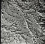
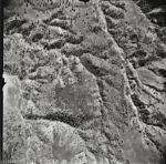
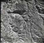
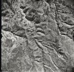
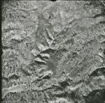
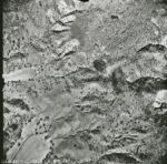
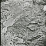
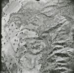
Description:
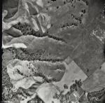
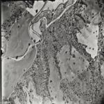
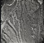
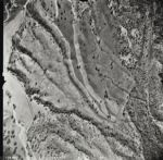
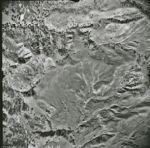
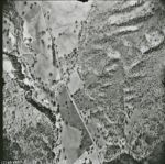
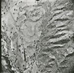
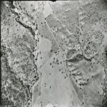
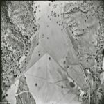
San Andreas Fault Zone, from San Francisco County line to Monterey County- San Luis Obispo County line. Flight has a total of approximately 8500 images
1966-D San Andreas Fault Zone Flight 0295B-WRD
Title:
1966-D San Andreas Fault Zone Flight 0295B-WRD
Creator:
Pacific Western Aerial Surveys
Type:
Image
Date Created:
[1966]
Description:
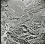
San Andreas Fault Zone, from San Francisco County line to Monterey County- San Luis Obispo County line. Flight has a total of approximately 8500 images
1966-D San Andreas Fault Zone Flight 0294B-WRD
Title:
1966-D San Andreas Fault Zone Flight 0294B-WRD
Creator:
Pacific Western Aerial Surveys
Type:
Image
Date Created:
[1966]
Description:
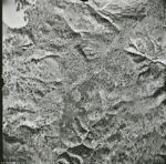
San Andreas Fault Zone, from San Francisco County line to Monterey County- San Luis Obispo County line. Flight has a total of approximately 8500 images
1966-D San Andreas Fault Zone Flight 0293B-WRD
Title:
1966-D San Andreas Fault Zone Flight 0293B-WRD
Creator:
Pacific Western Aerial Surveys
Type:
Image
Date Created:
[1966]
Description:
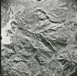
San Andreas Fault Zone, from San Francisco County line to Monterey County- San Luis Obispo County line. Flight has a total of approximately 8500 images
1966-D San Andreas Fault Zone Flight 0292B-WRD
Title:
1966-D San Andreas Fault Zone Flight 0292B-WRD
Creator:
Pacific Western Aerial Surveys
Type:
Image
Date Created:
[1966]
Description:
San Andreas Fault Zone, from San Francisco County line to Monterey County- San Luis Obispo County line. Flight has a total of approximately 8500 images
1966-D San Andreas Fault Zone Flight 0291B-WRD
Title:
1966-D San Andreas Fault Zone Flight 0291B-WRD
Creator:
Pacific Western Aerial Surveys
Type:
Image
Date Created:
[1966]
Description:
San Andreas Fault Zone, from San Francisco County line to Monterey County- San Luis Obispo County line. Flight has a total of approximately 8500 images
1966-D San Andreas Fault Zone Flight 0290B-WRD
Title:
1966-D San Andreas Fault Zone Flight 0290B-WRD
Creator:
Pacific Western Aerial Surveys
Type:
Image
Date Created:
[1966]
Description:
San Andreas Fault Zone, from San Francisco County line to Monterey County- San Luis Obispo County line. Flight has a total of approximately 8500 images
1966-D San Andreas Fault Zone Flight 0289B-WRD
Title:
1966-D San Andreas Fault Zone Flight 0289B-WRD
Creator:
Pacific Western Aerial Surveys
Type:
Image
Date Created:
[1966]
Description:
San Andreas Fault Zone, from San Francisco County line to Monterey County- San Luis Obispo County line. Flight has a total of approximately 8500 images
1966-D San Andreas Fault Zone Flight 0288B-WRD
Title:
1966-D San Andreas Fault Zone Flight 0288B-WRD
Creator:
Pacific Western Aerial Surveys
Type:
Image
Date Created:
[1966]
Description:
San Andreas Fault Zone, from San Francisco County line to Monterey County- San Luis Obispo County line. Flight has a total of approximately 8500 images
1966-D San Andreas Fault Zone Flight 0287B-WRD
Title:
1966-D San Andreas Fault Zone Flight 0287B-WRD
Creator:
Pacific Western Aerial Surveys
Type:
Image
Date Created:
[1966]
Description:
San Andreas Fault Zone, from San Francisco County line to Monterey County- San Luis Obispo County line. Flight has a total of approximately 8500 images
1966-D San Andreas Fault Zone Flight 0286B-WRD
Title:
1966-D San Andreas Fault Zone Flight 0286B-WRD
Creator:
Pacific Western Aerial Surveys
Type:
Image
Date Created:
[1966]
Description:
San Andreas Fault Zone, from San Francisco County line to Monterey County- San Luis Obispo County line. Flight has a total of approximately 8500 images
1966-D San Andreas Fault Zone Flight 0285B-WRD
Title:
1966-D San Andreas Fault Zone Flight 0285B-WRD
Creator:
Pacific Western Aerial Surveys
Type:
Image
Date Created:
[1966]
Description:
San Andreas Fault Zone, from San Francisco County line to Monterey County- San Luis Obispo County line. Flight has a total of approximately 8500 images
1966-D San Andreas Fault Zone Flight 0273B-WRD
Title:
1966-D San Andreas Fault Zone Flight 0273B-WRD
Creator:
Pacific Western Aerial Surveys
Type:
Image
Date Created:
[1966]
Description:
San Andreas Fault Zone, from San Francisco County line to Monterey County- San Luis Obispo County line. Flight has a total of approximately 8500 images
1966-D San Andreas Fault Zone Flight 0272B-WRD
Title:
1966-D San Andreas Fault Zone Flight 0272B-WRD
Creator:
Pacific Western Aerial Surveys
Type:
Image
Date Created:
[1966]
Description:
San Andreas Fault Zone, from San Francisco County line to Monterey County- San Luis Obispo County line. Flight has a total of approximately 8500 images
1966-D San Andreas Fault Zone Flight 0270B-WRD
Title:
1966-D San Andreas Fault Zone Flight 0270B-WRD
Creator:
Pacific Western Aerial Surveys
Type:
Image
Date Created:
[1966]
Description:
San Andreas Fault Zone, from San Francisco County line to Monterey County- San Luis Obispo County line. Flight has a total of approximately 8500 images
1966-D San Andreas Fault Zone Flight 0271B-WRD
Title:
1966-D San Andreas Fault Zone Flight 0271B-WRD
Creator:
Pacific Western Aerial Surveys
Type:
Image
Date Created:
[1966]
Description:
San Andreas Fault Zone, from San Francisco County line to Monterey County- San Luis Obispo County line. Flight has a total of approximately 8500 images
1966-D San Andreas Fault Zone Flight 0269B-WRD
Title:
1966-D San Andreas Fault Zone Flight 0269B-WRD
Creator:
Pacific Western Aerial Surveys
Type:
Image
Date Created:
[1966]
Description:
San Andreas Fault Zone, from San Francisco County line to Monterey County- San Luis Obispo County line. Flight has a total of approximately 8500 images
1966-D San Andreas Fault Zone Flight 0268B-WRD
Title:
1966-D San Andreas Fault Zone Flight 0268B-WRD
Creator:
Pacific Western Aerial Surveys
Type:
Image
Date Created:
[1966]
Description:
San Andreas Fault Zone, from San Francisco County line to Monterey County- San Luis Obispo County line. Flight has a total of approximately 8500 images
1966-D San Andreas Fault Zone Flight 0267B-WRD
Title:
1966-D San Andreas Fault Zone Flight 0267B-WRD
Creator:
Pacific Western Aerial Surveys
Type:
Image
Date Created:
[1966]
Description:
San Andreas Fault Zone, from San Francisco County line to Monterey County- San Luis Obispo County line. Flight has a total of approximately 8500 images
1966-D San Andreas Fault Zone Flight 0266B-WRD
Title:
1966-D San Andreas Fault Zone Flight 0266B-WRD
Creator:
Pacific Western Aerial Surveys
Type:
Image
Date Created:
[1966]
Description:
San Andreas Fault Zone, from San Francisco County line to Monterey County- San Luis Obispo County line. Flight has a total of approximately 8500 images
1966-D San Andreas Fault Zone Flight 0264B-WRD
Title:
1966-D San Andreas Fault Zone Flight 0264B-WRD
Creator:
Pacific Western Aerial Surveys
Type:
Image
Date Created:
[1966]
Description:
San Andreas Fault Zone, from San Francisco County line to Monterey County- San Luis Obispo County line. Flight has a total of approximately 8500 images
1966-D San Andreas Fault Zone Flight 0265B-WRD
Title:
1966-D San Andreas Fault Zone Flight 0265B-WRD
Creator:
Pacific Western Aerial Surveys
Type:
Image
Date Created:
[1966]
Description:
San Andreas Fault Zone, from San Francisco County line to Monterey County- San Luis Obispo County line. Flight has a total of approximately 8500 images
1966-D San Andreas Fault Zone Flight 0263B-WRD
Title:
1966-D San Andreas Fault Zone Flight 0263B-WRD
Creator:
Pacific Western Aerial Surveys
Type:
Image
Date Created:
[1966]
Description:
San Andreas Fault Zone, from San Francisco County line to Monterey County- San Luis Obispo County line. Flight has a total of approximately 8500 images
1966-D San Andreas Fault Zone Flight 0262B-WRD
Title:
1966-D San Andreas Fault Zone Flight 0262B-WRD
Creator:
Pacific Western Aerial Surveys
Type:
Image
Date Created:
[1966]
Description:
San Andreas Fault Zone, from San Francisco County line to Monterey County- San Luis Obispo County line. Flight has a total of approximately 8500 images
Previous
1
2
…
219
220
221
222
223
224
225
226
227
…
460
461
Next
Show Filters
Limit your search
Creator
Fairchild Aerial Surveys, inc.
1,774
American Aerial Surveys, Inc.
1,178
Pacific Western Aerial Surveys
989
Park Aerial Surveys, Inc.
988
Aero Service Corporation
816
more
Creators
»
Type
Image
10,801
Collection
90
People
University of California, Santa Cruz
167
Place
Salinas River
174
San Lorenzo River
167
Monterey Bay
133
Pajaro River
128
Santa Cruz Small Craft Harbor
116
more
Places
»
Topic
Coasts--California
2,238
Kelp bed ecology
656
Marine ecology
656
Earthquake damage
156
Harbors--California
56
more
Topics
»
Collection
UC Santa Cruz Aerial Photographs Collection
[remove]
11,058
1966-D San Andreas Fault Zone Flight
1,238
1949 San Benito County Flight BUX
987
1975 Santa Cruz County Flight SCZCO
707
1950 Santa Clara County Flight CIV
642
1937 Santa Cruz County and Monterey County Flight 13-ABG
449
1970 California Coastline Flight
445
1948 U.S. Forest Service Flight CDF-5
434
1986-87 Color Central California Coastline Flights CDBW-APU-C and CC-APU-C
434
1976-77 Color California Coastline Flight DNOD-AFU-C
379
1956-B Santa Cruz County Flight CJA
362
1939-F Santa Clara County Flight CIV
337
more
Collections
»
×
Digital Collections Feedback