Skip to Content
Toggle navigation
UC Santa Cruz
University Library
Contact Us
Browse Collections
Digital Collections
Photographs, audio recordings, publications, and more from our Special Collections & Archives
Search
Search
Search Constraints
Start Over
Filtering by:
Topic
Voyages and travels
Remove constraint Topic: Voyages and travels
Topic
Mountains
Remove constraint Topic: Mountains
Sort by relevance
relevance
Title ▼
Title ▲
Date Created ▼
Date Created ▲
Number of results to display per page
100 per page
10
per page
20
per page
24
per page
50
per page
100
per page
View results as:
List
Gallery
Masonry
Search Results
456 results for:
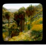
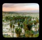
Riverside County, California: palm trees and desert wildflowers near Biskra Palms, Ind...
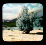
Colorado Desert, California: landscape with smoke trees (Psorothamnus spinosus)
Colorado Desert, California: landscape with smoke trees (Psorothamnus spinosus)
Colorado Desert, California: landscape with smoke trees (Psorothamnus spinosus)
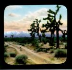
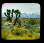
Mojave Desert, California: landscape with Joshua trees (Yucca brevifolia)
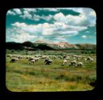
Mono County, California: herd of sheep grazing in Mono Craters Range of hills
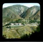
Arrowhead Springs Hotel: distant view of complex
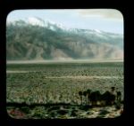
Colorado Desert, California: Mount San Jacinto from Two Bunch Palms
Colorado Desert, California: palm groves near Palm Springs
Colorado Desert, California: landscape with jumping cholla cactus, Mount San Jacinto i...
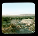
Colorado Desert, California: landscape with a stream, near Palm Springs
Colorado Desert, California. Palm Canyon near Palm Springs: view of Washington palms, ...
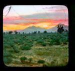
Mojave Desert, California: landscape at sunset with Joshua trees (Yucca brevifolia) an...
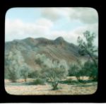
Colorado Desert, California: landscape with Mount San Jacinto in the background
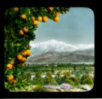
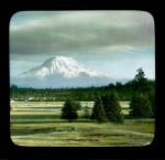
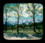
San Bernardino County, California. Mount San Gorgonio: distant view, over the orange g...
San Bernardino County, California. Mount San Gorgonio: distant view, over the orange g...
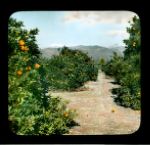
San Bernardino County, California: orange grove in Redlands Valley, with the San Berna...
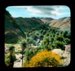
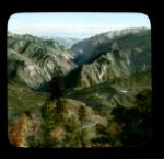
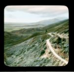
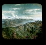
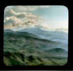
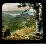
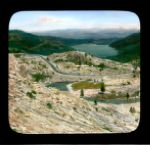
San Bernardino County, California. Rim of the World Drive: panoramic view of mountains...
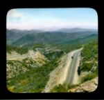
San Bernardino County, California. Rim of the World Drive: El Cajon Pass
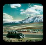
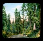
San Bernardino County, California. Rim of the World Drive: a car on El Cajon Pass
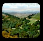
San Bernardino County, California. Rim of the World Drive: panoramic view down over a ...
San Bernardino County, California. Rim of the World Drive: snow-covered peaks
San Bernardino County, California. Rim of the World Drive: distant view of snow-covere...
San Bernardino County, California. Rim of the World Drive: mountain peaks above high s...
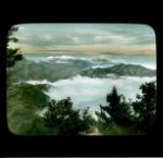
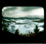
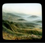
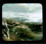
San Bernardino County, California. Rim of the World Drive: sea of fog
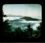
San Bernardino County, California. Rim of the World Drive: sea of fog
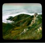
San Bernardino County, California. Rim of the World Drive: sea of fog
San Bernardino County, California. Rim of the World Drive: mountains in autumn
San Bernardino County, California. Rim of the World Drive: panoramic view of mountains
San Bernardino County, California. Rim of the World Drive: panoramic view of distant m...
San Bernardino County, California. Rim of the World Drive: panoramic view of mountains...
San Bernardino County, California. Rim of the World Drive: panoramic view of mountains...
Mojave Desert, California: landscape with Joshua trees (Yucca brevifolia), snowy mount...
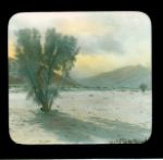
Colorado Desert, California: landscape with evening primrose (Oenothera sp.) bushes, m...
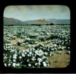
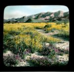
Colorado Desert, California: landscape with brittlebush (Encelia farinosa) and other w...
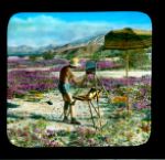
Colorado Desert, California: artist painting landscape of sand verbena (Abronia villos...
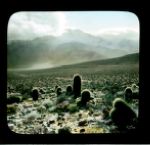
Mojave Desert, California: landscape with many cacti, with Mount San Jacinto in distance
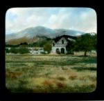
Monterey County, California. Mission San Antonio de Padua: exterior
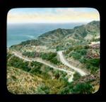
Santa Catalina Island, California: view from above of a switchbacked road
San Francisco, California. Mount Tamalpais: view from mountain towards bay
Donner Lake, California: view from Donner Pass, Donner Memorial State Park
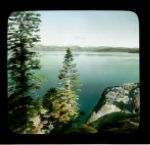
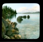
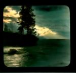
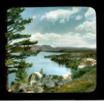
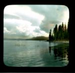
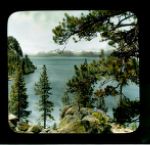
Lake Tahoe, California: partial view of lake, from shore
Lake Tahoe, California: partial view of lake, from shore
Lake Tahoe, California: partial view of lake, with pier
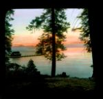
Lake Tahoe, California: partial view of lake at evening
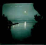
Lake Tahoe, California: partial view of lake in moonlight
Lake Tahoe, California: partial view of lake, from shore
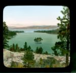
Lake Tahoe, California: Emerald Bay with Teahouse Island
Lake Tahoe, California: Lake Tahoe and Tavern Pier
Lake Tahoe, California: partial view of lake, from shore
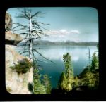
Lake Tahoe, California: partial view of lake, with snow-capped peaks in the distance
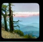
Mount Shasta, California: distant view of mountain peak, from south
Mount Shasta, California: distant view of mountain peak, from north
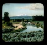
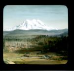
Mount Shasta, California: distant view of mountain peak, with farm (?) below
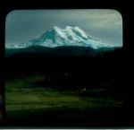
Mount Shasta, California: distant view of mountain peak, with farm (?) below
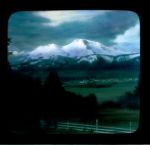
Mount Shasta, California: distant view of mountain peak, with farm (?) below
Mount Shasta, California: distant view of mountain peak, with small town (Mount Shasta...
Mount Shasta, California: distant view of mountain peak, with small town below
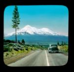
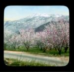
Mount Shasta, California: distant view of mountain peak, with orchard trees in foreground
California: Sierra Nevada range, from the Owens Valley, with a cattle ranch in the for...
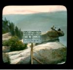
Yosemite National Park. Overhanging Rock on Glacier Point: view of warning sign, with ...
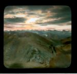
Sequoia National Park. Great Western Divide: view from Alta Peak
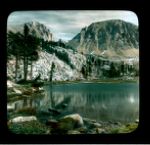
Sequoia National Park: Timberline Lake, with Mount Whitney to the east
Sequoia National Park: Timberline Lake, with Mount Muir above
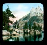
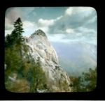
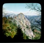
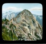
Sequoia National Park: west side of Moro Rock
Sequoia National Park: west side of Moro Rock
Sequoia National Park: west side of Moro Rock
Sequoia National Park: sunset view of Sequoia National Park, from Beetle Rock
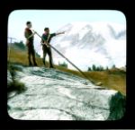
Kings Canyon National Park. Paradise Valley: view with two Boy Scouts with alpine horns
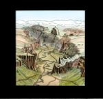
Yosemite National Park: diagram of Yosemite National Park. Yosemite Valley: with numbe...
Yosemite National Park. Firefall at Glacier Point: view from valley floor
Yosemite National Park. Firefall at Glacier Point: view of bonfire
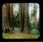
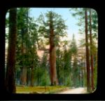
Yosemite National Park: Mariposa Grove of giant sequoias (Sequoiadendron giganteum), c...
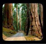
Yosemite National Park: Mariposa Grove of giant sequoias (Sequoiadendron giganteum)
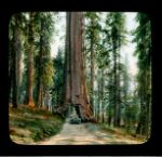
Yosemite National Park. Wawona Tree (Sequoiadendron giganteum) in Mariposa Grove: view...
Yosemite National Park. Grizzly Giant, Mariposa Grove: view of entire tree
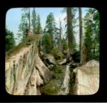
Yosemite National Park. Massachusetts Tree: close-up view of fallen tree in Mariposa G...
Yosemite National Park. Wawona Tree (Sequoiadendron giganteum) in Mariposa Grove: dist...
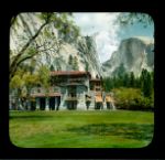
Yosemite National Park. Ahwahnee Hotel: exterior
Yosemite National Park. Ahwahnee Hotel: exterior
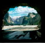
Yosemite National Park: entrance to Yosemite Valley from Wawona Tunnel
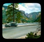
Yosemite National Park: road in Yosemite, Route 41, with Half Dome in the distance
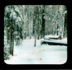
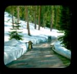
Yosemite National Park: road in Yosemite, with snow about 3 feet deep on either side, ...
Yosemite National Park: road in Yosemite, with snow about 3 feet deep on either side, ...
Yosemite National Park. Wawona Road: view towards south, from Chinquapin
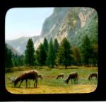
Yosemite National Park: elk grazing in Yosemite Valley
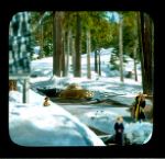
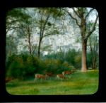
Yosemite National Park: mule deer grazing in Yosemite Valley
Yosemite National Park: Miwok Indian dwellings at the base of a cliff
Yosemite National Park: sequoia tree (Sequoiadendron giganteum, looking upwards along ...
Yosemite National Park: Yosemite Valley wildflowers in bloom, with El Capitan and Glac...
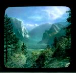
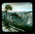
Yosemite National Park. Yosemite Valley: view of El Capitan and Glacier Point, with Ha...
Yosemite National Park. Yosemite Valley: view towards El Capitan and Glacier Point, at...
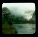
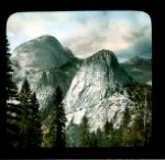
Yosemite National Park. Yosemite Valley: Half Dome and the Merced River
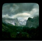
Yosemite National Park. Yosemite Valley: storm clouds over Cathedral Rocks and Merced ...
Yosemite National Park. Half Dome: view at daybreak, from Glacier Point
Yosemite National Park. Yosemite Valley: view east towards El Capitan, with Bridalveil...
Yosemite National Park. Yosemite Valley: view west towards El Capitan from Sentinel Dome
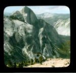
Yosemite National Park. Half Dome: view from Mount Watkins
Yosemite National Park. Granite domes (left, back of Half Dome, right, Liberty Cap)
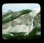
Yosemite National Park: waterfall in Yosemite, Mount Watkins
Previous
1
2
3
4
5
Next
Show Filters
Limit your search
Creator
DeCou, Branson, 1892-1941
451
Putnam & Valentine
23
Frasher, Burton
22
Hullinger, B.
5
Tibbitts, Howard Clinton
4
more
Creators
»
Type
Image
456
Series
Dream Pictures and Travelogues, Branson DeCou
380
American Travelogues, Branson DeCou
76
People
Walther, von der Vogelweide, active 12th century
1
Place
Dolomites
49
Lake Garda
37
Yosemite National Park
27
Death Valley
25
Yosemite Valley
14
more
Places
»
Topic
Mountains
[remove]
456
Voyages and travels
[remove]
456
Landscape photography
398
Panoramas
226
Landscapes
218
more
Topics
»
Collection
Branson DeCou Archive
456
×
Digital Collections Feedback