Skip to Content
Toggle navigation
UC Santa Cruz
University Library
Contact Us
Browse Collections
Digital Collections
Photographs, audio recordings, publications, and more from our Special Collections & Archives
Search
Search
Search Constraints
Start Over
Filtering by:
Creator
United States. Army. Corps of Engineers
Remove constraint Creator: United States. Army. Corps of Engineers
Sort by relevance
relevance
Title ▼
Title ▲
Date Created ▼
Date Created ▲
Number of results to display per page
24 per page
10
per page
20
per page
24
per page
50
per page
100
per page
View results as:
List
Gallery
Masonry
Search Results
441 results for:
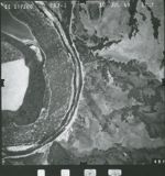
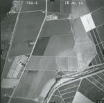
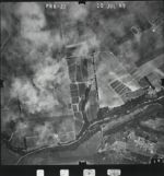
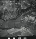
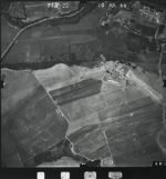
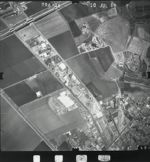
1969-G Pajaro River and Vicinity Flight PR 7-12
Title:
1969-G Pajaro River and Vicinity Flight PR 7-12
Creator:
United States. Army. Corps of Engineers
Type:
Image
Date Created:
[1969]
Description:
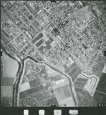
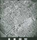
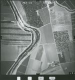
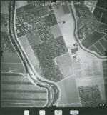
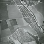
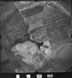
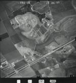
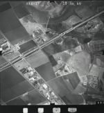
Pajaro River basin from mouth of Pajaro to Chittenden Pass; includes Watsonville urban area, Freedom and airport, including Pajaro.
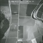
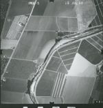
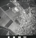
1969-G Pajaro River and Vicinity Flight PR 7-13
Title:
1969-G Pajaro River and Vicinity Flight PR 7-13
Creator:
United States. Army. Corps of Engineers
Type:
Image
Date Created:
[1969]
Description:
Pajaro River basin from mouth of Pajaro to Chittenden Pass; includes Watsonville urban area, Freedom and airport, including Pajaro.
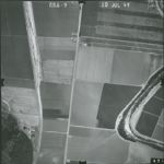
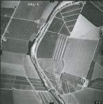
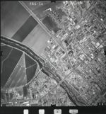
1969-G Pajaro River and Vicinity Flight PR 7-14
Title:
1969-G Pajaro River and Vicinity Flight PR 7-14
Creator:
United States. Army. Corps of Engineers
Type:
Image
Date Created:
[1969]
Description:
Pajaro River basin from mouth of Pajaro to Chittenden Pass; includes Watsonville urban area, Freedom and airport, including Pajaro.
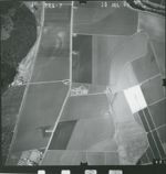
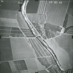
1969-G Pajaro River and Vicinity Flight PR 7-10
Title:
1969-G Pajaro River and Vicinity Flight PR 7-10
Creator:
United States. Army. Corps of Engineers
Type:
Image
Date Created:
[1969]
Description:
Pajaro River basin from mouth of Pajaro to Chittenden Pass; includes Watsonville urban area, Freedom and airport, including Pajaro.
1969-G Pajaro River and Vicinity Flight PR 7-11
Title:
1969-G Pajaro River and Vicinity Flight PR 7-11
Creator:
United States. Army. Corps of Engineers
Type:
Image
Date Created:
[1969]
Description:
Pajaro River basin from mouth of Pajaro to Chittenden Pass; includes Watsonville urban area, Freedom and airport, including Pajaro.
1969-G Pajaro River and Vicinity Flight PR 7-1
Title:
1969-G Pajaro River and Vicinity Flight PR 7-1
Creator:
United States. Army. Corps of Engineers
Type:
Image
Date Created:
[1969]
Description:
Pajaro River basin from mouth of Pajaro to Chittenden Pass; includes Watsonville urban area, Freedom and airport, including Pajaro.
1969-G Pajaro River and Vicinity Flight PR 6-8
Title:
1969-G Pajaro River and Vicinity Flight PR 6-8
Creator:
United States. Army. Corps of Engineers
Type:
Image
Date Created:
[1969]
Description:
Pajaro River basin from mouth of Pajaro to Chittenden Pass; includes Watsonville urban area, Freedom and airport, including Pajaro.
1969-G Pajaro River and Vicinity Flight PR 6-9
Title:
1969-G Pajaro River and Vicinity Flight PR 6-9
Creator:
United States. Army. Corps of Engineers
Type:
Image
Date Created:
[1969]
Description:
Pajaro River basin from mouth of Pajaro to Chittenden Pass; includes Watsonville urban area, Freedom and airport, including Pajaro.
1969-G Pajaro River and Vicinity Flight PR 6-7
Title:
1969-G Pajaro River and Vicinity Flight PR 6-7
Creator:
United States. Army. Corps of Engineers
Type:
Image
Date Created:
[1969]
Description:
Pajaro River basin from mouth of Pajaro to Chittenden Pass; includes Watsonville urban area, Freedom and airport, including Pajaro.
1969-G Pajaro River and Vicinity Flight PR 6-6
Title:
1969-G Pajaro River and Vicinity Flight PR 6-6
Creator:
United States. Army. Corps of Engineers
Type:
Image
Date Created:
[1969]
Description:
Pajaro River basin from mouth of Pajaro to Chittenden Pass; includes Watsonville urban area, Freedom and airport, including Pajaro.
1969-G Pajaro River and Vicinity Flight PR 6-5
Title:
1969-G Pajaro River and Vicinity Flight PR 6-5
Creator:
United States. Army. Corps of Engineers
Type:
Image
Date Created:
[1969]
Description:
Pajaro River basin from mouth of Pajaro to Chittenden Pass; includes Watsonville urban area, Freedom and airport, including Pajaro.
1969-G Pajaro River and Vicinity Flight PR 6-4
Title:
1969-G Pajaro River and Vicinity Flight PR 6-4
Creator:
United States. Army. Corps of Engineers
Type:
Image
Date Created:
[1969]
Description:
Pajaro River basin from mouth of Pajaro to Chittenden Pass; includes Watsonville urban area, Freedom and airport, including Pajaro.
1969-G Pajaro River and Vicinity Flight PR 6-3
Title:
1969-G Pajaro River and Vicinity Flight PR 6-3
Creator:
United States. Army. Corps of Engineers
Type:
Image
Date Created:
[1969]
Description:
Pajaro River basin from mouth of Pajaro to Chittenden Pass; includes Watsonville urban area, Freedom and airport, including Pajaro.
1969-G Pajaro River and Vicinity Flight PR 6-22
Title:
1969-G Pajaro River and Vicinity Flight PR 6-22
Creator:
United States. Army. Corps of Engineers
Type:
Image
Date Created:
[1969]
Description:
Pajaro River basin from mouth of Pajaro to Chittenden Pass; includes Watsonville urban area, Freedom and airport, including Pajaro.
1969-G Pajaro River and Vicinity Flight PR 6-23
Title:
1969-G Pajaro River and Vicinity Flight PR 6-23
Creator:
United States. Army. Corps of Engineers
Type:
Image
Date Created:
[1969]
Description:
Pajaro River basin from mouth of Pajaro to Chittenden Pass; includes Watsonville urban area, Freedom and airport, including Pajaro.
1969-G Pajaro River and Vicinity Flight PR 6-21
Title:
1969-G Pajaro River and Vicinity Flight PR 6-21
Creator:
United States. Army. Corps of Engineers
Type:
Image
Date Created:
[1969]
Description:
Pajaro River basin from mouth of Pajaro to Chittenden Pass; includes Watsonville urban area, Freedom and airport, including Pajaro.
1969-G Pajaro River and Vicinity Flight PR 6-20
Title:
1969-G Pajaro River and Vicinity Flight PR 6-20
Creator:
United States. Army. Corps of Engineers
Type:
Image
Date Created:
[1969]
Description:
Pajaro River basin from mouth of Pajaro to Chittenden Pass; includes Watsonville urban area, Freedom and airport, including Pajaro.
1969-G Pajaro River and Vicinity Flight PR 6-2
Title:
1969-G Pajaro River and Vicinity Flight PR 6-2
Creator:
United States. Army. Corps of Engineers
Type:
Image
Date Created:
[1969]
Description:
Pajaro River basin from mouth of Pajaro to Chittenden Pass; includes Watsonville urban area, Freedom and airport, including Pajaro.
1969-G Pajaro River and Vicinity Flight PR 6-19
Title:
1969-G Pajaro River and Vicinity Flight PR 6-19
Creator:
United States. Army. Corps of Engineers
Type:
Image
Date Created:
[1969]
Description:
Pajaro River basin from mouth of Pajaro to Chittenden Pass; includes Watsonville urban area, Freedom and airport, including Pajaro.
1969-G Pajaro River and Vicinity Flight PR 6-18
Title:
1969-G Pajaro River and Vicinity Flight PR 6-18
Creator:
United States. Army. Corps of Engineers
Type:
Image
Date Created:
[1969]
Description:
Pajaro River basin from mouth of Pajaro to Chittenden Pass; includes Watsonville urban area, Freedom and airport, including Pajaro.
1969-G Pajaro River and Vicinity Flight PR 6-17
Title:
1969-G Pajaro River and Vicinity Flight PR 6-17
Creator:
United States. Army. Corps of Engineers
Type:
Image
Date Created:
[1969]
Description:
Pajaro River basin from mouth of Pajaro to Chittenden Pass; includes Watsonville urban area, Freedom and airport, including Pajaro.
1969-G Pajaro River and Vicinity Flight PR 6-16
Title:
1969-G Pajaro River and Vicinity Flight PR 6-16
Creator:
United States. Army. Corps of Engineers
Type:
Image
Date Created:
[1969]
Description:
Pajaro River basin from mouth of Pajaro to Chittenden Pass; includes Watsonville urban area, Freedom and airport, including Pajaro.
1969-G Pajaro River and Vicinity Flight PR 6-15
Title:
1969-G Pajaro River and Vicinity Flight PR 6-15
Creator:
United States. Army. Corps of Engineers
Type:
Image
Date Created:
[1969]
Description:
Pajaro River basin from mouth of Pajaro to Chittenden Pass; includes Watsonville urban area, Freedom and airport, including Pajaro.
1969-G Pajaro River and Vicinity Flight PR 6-14
Title:
1969-G Pajaro River and Vicinity Flight PR 6-14
Creator:
United States. Army. Corps of Engineers
Type:
Image
Date Created:
[1969]
Description:
Pajaro River basin from mouth of Pajaro to Chittenden Pass; includes Watsonville urban area, Freedom and airport, including Pajaro.
Previous
1
2
3
4
5
6
7
…
18
19
Next
Show Filters
Limit your search
Creator
United States. Army. Corps of Engineers
[remove]
441
Type
Image
411
Collection
30
Place
Monterey Bay
95
Santa Cruz Small Craft Harbor
49
Santa Cruz County
28
San Lorenzo River
23
Santa Cruz
22
more
Places
»
Topic
Coasts--California
192
Harbors--California
47
Wharves--California
3
Collection
UC Santa Cruz Aerial Photographs Collection
441
1969-G Pajaro River and Vicinity Flight PR
155
1953 Santa Cruz County Flight CCL
78
1965-F Santa Cruz County Coastline Flight SC
28
1965-D Santa Cruz County Coastline Flight SC
15
1956-A Soquel Creek and Vicinity Flight SR
12
1963-F Santa Cruz Coastline Flight SC
9
1967-A Santa Cruz County Coastline Flight SC
8
1968-A Santa Cruz Small Craft Harbor Flight SC
8
1963-D Santa Cruz Coastline Flight SC
7
1966-C Santa Cruz County Coastline Flight SC
7
1962-C Santa Cruz County Flight SCH
6
more
Collections
»
×
Digital Collections Feedback