Search Constraints
Filtering by:
Type
Collection
Remove constraint Type: Collection
Place
Santa Cruz County
Remove constraint Place: Santa Cruz County
Number of results to display per page
Search Results
85 results for:
-
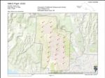
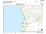
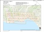
1969-G Pajaro River and Vicinity Flight PR
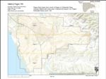 Type:Place:Date Created:[1969]Subject:Monterey County, Watsonville Municipal Airport, Freedom, Watsonville, Santa Cruz County, and Pajaro RiverCall Number:1969-G
 -
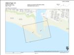
1969-C Santa Cruz Small Craft Harbor Flight SC
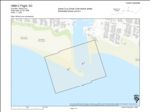 Type:Place:Topic:Date Created:[1969]Description:Subject:Harbors--California, Santa Cruz County, and Santa Cruz Small Craft HarborCall Number:1969-C
 -
1969-B Santa Cruz Small Craft Harbor Flight SC
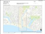 Type:Place:Topic:Date Created:[1969]Subject:Harbors--California, Santa Cruz County, Santa Cruz, and Santa Cruz Small Craft HarborCall Number:1969-B
 -
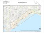
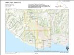
1969-A Santa Cruz City and County Urban Area Flight SC
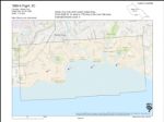 Type:Place:Topic:Date Created:[1969]Description:Subject:Coasts--California, Santa Cruz County, Santa Cruz, and Live OakCall Number:1969-A
 -
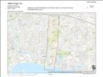
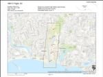
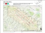
1968-D University of California Campus and Vicinity Flight UCSC
 Type:Place:Date Created:1968Subject:University of California, Santa Cruz, Santa Cruz County, and Santa CruzCall Number:1968-D
 -
1968-B Santa Cruz Small Craft Harbor Flight SC
 Variant Title:Type:Place:Topic:Date Created:[1968]Description:Subject:Harbors--California, Santa Cruz County, and Santa Cruz Small Craft HarborCall Number:1968-B
 -
1968-A Santa Cruz Small Craft Harbor Flight SC
 Type:Place:Topic:Date Created:[1968]Subject:Harbors--California, Santa Cruz County, Santa Cruz, and Santa Cruz Small Craft HarborCall Number:1968-A
 -
1967-M San Mateo and Santa Cruz Counties Flight CCL 2
 Variant Title:Type:Place:Topic:Date Created:[1967]Description:Subject:Coasts--California, Waddell Creek, Wilder Ranch State Park, Santa Cruz, Santa Cruz Small Craft Harbor, San Lorenzo River Mouth, Antonelli Pond, Live Oak, San Mateo, Año Nuevo State Park, Greyhound Rock, Natural Bridges State Beach, Lighthouse Field, and Santa Cruz CountyCall Number:1967-M
 -
1967-K Capitola Coastline Flight SC
 Type:Place:Topic:Date Created:[1967]Description:Subject:Coasts--California, Santa Cruz County, and CapitolaCall Number:1967-K
 -
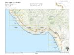
1967-E California Coastline
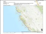 Title:Variant Title:Type:Place:Waddell Creek, San Luis Obispo, Wilder Ranch State Park, Capitola, Pajaro Valley, Los Padres National Forest, Santa Cruz, Santa Cruz Small Craft Harbor, Half Moon Bay, San Lorenzo River Mouth, Antonelli Pond, Live Oak, Pillar Point, San Mateo, Big Sur, Monterey, Pescadero, Monterey County, Santa Cruz County, Soquel Point, Montara State Beach, Elkhorn Slough, Greyhound Rock, and Natural Bridges State BeachTopic:Date Created:1967Subject:Coasts--California, Kelp bed ecology, Marine ecology, Waddell Creek, San Luis Obispo, Wilder Ranch State Park, Capitola, Pajaro Valley, Los Padres National Forest, Santa Cruz, Santa Cruz Small Craft Harbor, Half Moon Bay, San Lorenzo River Mouth, Antonelli Pond, Live Oak, Pillar Point, San Mateo, Big Sur, Monterey, Pescadero, Monterey County, Santa Cruz County, Soquel Point, Montara State Beach, Elkhorn Slough, Greyhound Rock, and Natural Bridges State BeachCall Number:1967-E
 -
1967-C Santa Cruz Small Craft Harbor Flight SC
 Type:Place:Topic:Date Created:[1967]Subject:Harbors--California, Santa Cruz County, Santa Cruz, and Santa Cruz Small Craft HarborCall Number:1967-C
 -
1967-B Santa Cruz Small Craft Harbor Jetties Flight SC
 Type:Place:Topic:Date Created:[1967]Description:Subject:Harbors--California, Santa Cruz County, and Santa Cruz Small Craft HarborCall Number:1967-B
 -
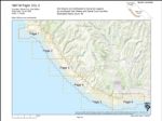
1967-A Santa Cruz County Coastline Flight SC
 Type:Place:Topic:Date Created:[1967]Description:Subject:Coasts--California, Santa Cruz County, Soquel Point, and CapitolaCall Number:1967-A
 -
1969-E City of Capitola Coastline Flight SC
 Type:Place:Topic:Date Created:[1969]Description:Subject:Coasts--California, Santa Cruz County, and CapitolaCall Number:1969-E
 -
1976-77 Color California Coastline Flight DNOD-AFU-C
 Variant Title:Creator:Type:Place:Topic:Date Created:1977Subject:Coasts--California, Santa Cruz County, San Mateo, and Monterey CountyCall Number:1976-77
 -
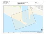
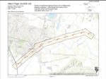
2003-L Live Oak, Santa Cruz County Flight AMBAG
 Creator:Type:Place:Date Created:2003Description:Subject:Santa Cruz County and Live OakCall Number:2003-L
 -
2001 Santa Cruz County Coastline Flight CCC-BQK-C
 Creator:Type:Place:Topic:Date Created:2001Description:Subject:Coasts--California and Santa Cruz CountyCall Number:2001
 -
1989-I Monterey Bay Coastline Flight USGS Monterey Bay
 Variant Title:Creator:Type:Place:Topic:Date Created:1989Description:Subject:Coasts--California, Santa Cruz County, Salinas, Elkhorn Slough, Moss Landing, Watsonville, Monterey County, Pajaro Valley, and MarinaCall Number:1989-I
 -
1989-H San Andreas Fault Zone Flight GSLPQ
 Variant Title:Creator:Type:Place:Topic:Date Created:1989Subject:Earthquake damage, Santa Cruz County, San Andreas Fault, Pajaro Valley, Santa Clara, San Benito, and San Juan BautistaCall Number:1989-H
 -
1989-E University of California-Santa Cruz Flight 89308
 Creator:Type:Date Created:1989Subject:University of California, Santa Cruz, Santa Cruz County, Santa Cruz, University of California Santa Cruz, and PogonipCall Number:1989-E
 -
1989-B Central Santa Cruz County Flight AV 3662-A
 Creator:Type:Place:Topic:Date Created:1989Subject:Coasts--California and Santa Cruz CountyCall Number:1989-B
 -
1985-C Lexington Reservoir Drainage Flight 853012
 Variant Title:Creator:Type:Place:Date Created:1985Subject:Santa Cruz County, Santa Clara, and Lexington ReservoirCall Number:1985-C
 -
1984-C California Highway Route 129 Flight 04-SCR-129
 Creator:Type:Place:Date Created:1984Subject:Santa Cruz County and WatsonvilleCall Number:1984-C
 -
1983-D Highway 9 from Santa Cruz to Los Gatos Flight 04-SCL-9
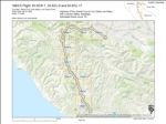 Variant Title:Creator:Type:Place:Date Created:1983Subject:Santa Cruz County and Santa ClaraCall Number:1983-D
Limit your search
- Santa Cruz County[remove]85
- Santa Cruz42
- Santa Cruz Small Craft Harbor36
- Live Oak23
- San Lorenzo River Mouth23
- more Places »