Search Constraints
Filtering by:
Collection
UC Santa Cruz Aerial Photographs Collection
Remove constraint Collection: UC Santa Cruz Aerial Photographs Collection
Place
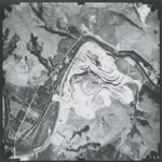
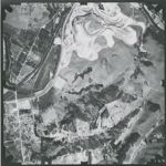
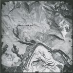
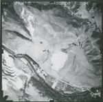
Pajaro River
Remove constraint Place: Pajaro River
Number of results to display per page
Search Results
128 results for:
-
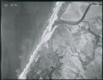
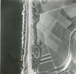
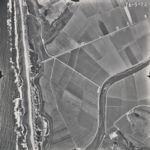
1928-F California Coastline Flight 131-119 5
 Creator:Type:Place:Topic:Date Created:[1928]Subject:Coasts--California, Watsonville Slough, and Pajaro River
 -
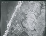
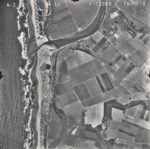
1928-F California Coastline Flight 131-119 6
 Creator:Type:Place:Topic:Date Created:[1928]Subject:Coasts--California, Watsonville Slough, and Pajaro River
 -
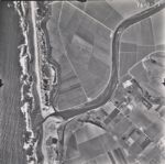
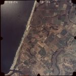
1928-G California Coastline Flight SC-2
 Creator:Type:Place:Topic:Date Created:[1928]Subject:Coasts--California and Pajaro River
 -
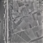
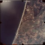
1928-G California Coastline Flight SC-4
 Creator:Type:Place:Topic:Date Created:[1928]Subject:Coasts--California, Watsonville Slough, and Pajaro River
 -
1928-G California Coastline Flight SC-3
 Creator:Type:Place:Topic:Date Created:[1928]Subject:Coasts--California and Pajaro River
 -
1928-G California Coastline Flight SC-7
 Creator:Type:Place:Topic:Date Created:[1928]Subject:Coasts--California, Watsonville Slough, and Pajaro River
 -
1928-G California Coastline Flight SC-8
 Creator:Type:Place:Topic:Date Created:[1928]Subject:Coasts--California, Watsonville Slough, and Pajaro River
 -
1928-G California Coastline Flight SC-9
 Creator:Type:Place:Topic:Date Created:[1928]Subject:Coasts--California, Watsonville Slough, and Pajaro River
 -
1935 Santa Cruz County Flight C-3300 106
 Creator:Type:Place:Date Created:1935Description:Subject:Pajaro Valley and Pajaro River
 -
1935 Santa Cruz County Flight C-3300 113
 Creator:Type:Place:Date Created:1935Description:Subject:Watsonville Slough, Pacific Ocean, and Pajaro River
 -
1935 Santa Cruz County Flight C-3300 60b
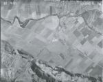
 Creator:Type:Place:Date Created:1935Description:Subject:Pajaro River and Coward Creek
 -
1935 Santa Cruz County Flight C-3300 77c
 Creator:Type:Place:Date Created:1935Description:Subject:Pajaro River and Coward Creek
 -
1935 Santa Cruz County Flight C-3300 92
 Creator:Type:Place:Date Created:1935Description:Subject:Pajaro River and Ramsay Park
 -
1935 Santa Cruz County Flight C-3300 92a
 Creator:Type:Place:Date Created:1935Description:Subject:Pajaro Valley and Pajaro River
 -
1937 Santa Cruz County and Monterey County Flight 13-ABG 4-33
 Creator:Type:Place:Date Created:[1937]Subject:Pacific Ocean and Pajaro River
 -
1937 Santa Cruz County and Monterey County Flight 13-ABG 4-34
 Creator:Type:Place:Date Created:[1937]Subject:Pacific Ocean and Pajaro River
 -
1937 Santa Cruz County and Monterey County Flight 13-ABG 4-35
 Creator:Type:Place:Date Created:[1937]Subject:Monterey Bay, Pajaro River, Zmudowski State Beach, and Pacific Ocean
 -
1937 Santa Cruz County and Monterey County Flight 13-ABG 4-36
 Creator:Type:Place:Date Created:[1937]Subject:Pacific Ocean, Pajaro River, Moss Landing, and Zmudowski State Beach
 -
1937 Santa Cruz County and Monterey County Flight 13-ABG 5-11
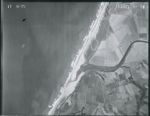
 Creator:Type:Place:Date Created:[1937]Subject:Pajaro River and Elkhorn Slough
 -
1937 Santa Cruz County and Monterey County Flight 13-ABG 5-10
 Creator:Type:Place:Date Created:[1937]Subject:Pajaro River
 -
1937 Santa Cruz County and Monterey County Flight 13-ABG 5-52
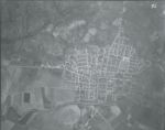
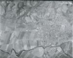 Creator:Type:Place:Date Created:[1937]Subject:Pajaro River and Watsonville
 -
1937 Santa Cruz County and Monterey County Flight 13-ABG 5-53
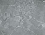
 Creator:Type:Place:Date Created:[1937]Subject:Pajaro River and Watsonville
 -
1937 Santa Cruz County and Monterey County Flight 13-ABG 5-54
 Creator:Type:Place:Date Created:[1937]Subject:Pajaro River, Pajaro Valley, and Watsonville
 -
1937 Santa Cruz County and Monterey County Flight 13-ABG 5-8
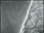
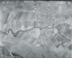
 Creator:Type:Place:Date Created:[1937]Subject:Pacific Ocean, Pajaro River, and Watsonville
 -
1939-A Santa Cruz County Flight CJA
 Variant Title:Creator:Type:Place:Date Created:[1939]Subject:Elkhorn Slough and Pajaro RiverCall Number:1939-A
 -
1937 Santa Cruz County and Monterey County Flight 13-ABG 5-9
 Creator:Type:Place:Date Created:[1937]Subject:Pajaro River and Watsonville
 -
1939-A Santa Cruz County Flight CJA 293-100
 Creator:Type:Place:Date Created:[1939]Subject:Pajaro River, Pescadero Creek, and River Oaks
 -
1939-A Santa Cruz County Flight CJA 293-99
 Creator:Type:Place:Date Created:[1939]Subject:Soda Lake, Pajaro River, and Pescadero Creek
 -
1939-A Santa Cruz County Flight CJA 297-106
 Creator:Type:Place:Date Created:[1939]Subject:Pajaro River, Pajaro Valley, and Watsonville
 -
1939-A Santa Cruz County Flight CJA 297-49
 Creator:Type:Place:Date Created:[1939]Subject:Pajaro River and Pajaro Valley
 -
1939-A Santa Cruz County Flight CJA 297-50
 Creator:Type:Place:Date Created:[1939]Subject:Pajaro River and Pajaro Valley
 -
1939-A Santa Cruz County Flight CJA 298-14
 Creator:Type:Place:Date Created:[1939]Subject:Pajaro River
 -
1939-A Santa Cruz County Flight CJA 298-19
 Creator:Type:Place:Date Created:[1939]Subject:Pajaro River
 -
1939-A Santa Cruz County Flight CJA 298-20
 Creator:Type:Place:Date Created:[1939]Subject:Pajaro River
 -
1939-A Santa Cruz County Flight CJA 298-21
 Creator:Type:Place:Date Created:[1939]Subject:Pajaro River, Harkins Slough, and Watsonville Slough
 -
1939-A Santa Cruz County Flight CJA 298-43
 Creator:Type:Place:Date Created:[1939]Subject:Pacific Ocean, Pajaro River, and Zmudowski State Beach
 -
1939-A Santa Cruz County Flight CJA 298-44
 Creator:Type:Place:Date Created:[1939]Subject:Pacific Ocean and Pajaro River
 -
1939-A Santa Cruz County Flight CJA 298-45
 Creator:Type:Place:Date Created:[1939]Subject:Pacific Ocean and Pajaro River
 -
1939-A Santa Cruz County Flight CJA 298-46
 Creator:Type:Place:Date Created:[1939]Subject:Pacific Ocean, Pajaro River, and Watsonville
 -
1939-A Santa Cruz County Flight CJA 299-4
-
1939-A Santa Cruz County Flight CJA 299-5
-
1939-A Santa Cruz County Flight CJA 299-6
 Creator:Type:Place:Date Created:[1939]Subject:Pajaro River, Aromas, and Watsonville
 -
1939-A Santa Cruz County Flight CJA 299-7
 Creator:Type:Place:Date Created:[1939]Subject:Pajaro River, Aromas, and Watsonville
 -
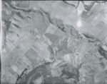
1948 U.S. Forest Service Flight CDF-5 4-65
 Creator:Place:Date Created:1948Description:Subject:Pajaro River and Chittenden Pass
 -
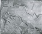
1948 U.S. Forest Service Flight CDF-5 4-79
 Creator:Place:Date Created:1948Description:Subject:Pajaro Gap, Chittenden Pass, and Pajaro River
 -
1965-D Santa Cruz County Coastline Flight SC 1-156
 Type:Topic:Date Created:[1965]Description:Subject:Coasts--California, Monterey Bay, Palm Beach (historical), Pajaro River, and Pajaro Dunes Condominiums
 -
1965-D Santa Cruz County Coastline Flight SC 1-157
 Type:Place:Topic:Date Created:[1965]Description:Subject:Coasts--California, Monterey Bay, and Pajaro River
 -
1965-D Santa Cruz County Coastline Flight SC 1-158
 Type:Place:Topic:Date Created:[1965]Description:Subject:Coasts--California, Zmudowski State Beach, Monterey Bay, and Pajaro River
 -
1970 California Coastline Flight 76-5-70
 Type:Place:Topic:Date Created:[1970]Subject:Kelp bed ecology, Marine ecology, Coasts--California, Pajaro River, and McClusky Slough
 -
1970 California Coastline Flight 76-5-71
 Type:Place:Topic:Date Created:[1970]Subject:Kelp bed ecology, Marine ecology, Coasts--California, and Pajaro River
 -
1970 California Coastline Flight 76-5-73
 Type:Place:Topic:Date Created:[1970]Subject:Kelp bed ecology, Marine ecology, Coasts--California, Watsonville Slough, and Pajaro River
 -
1970 California Coastline Flight 76-5-72
 Type:Place:Topic:Date Created:[1970]Subject:Kelp bed ecology, Marine ecology, Coasts--California, Watsonville Slough, and Pajaro River
 -
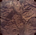
1974 Color San Andreas Fault Zone Flight 10-164
 Creator:Type:Date Created:1974Subject:Palm Beach (historical), Elkhorn Slough, Pajaro River, and Pajaro Dunes Condominiums
 -
1974 Color San Andreas Fault Zone Flight 10-165
 Creator:Type:Place:Date Created:1974Subject:Sunset State Beach and Pajaro River
 -
1974 Color San Andreas Fault Zone Flight 13-212
 Creator:Type:Place:Date Created:1974Subject:Soda Lake, A.R. Wilson Quarry, and Pajaro River
 -
1974 Color San Andreas Fault Zone Flight 13-211
 Creator:Type:Place:Date Created:1974Subject:Pajaro River
 -
1974 Color San Andreas Fault Zone Flight 13-213
 Creator:Type:Place:Date Created:1974Subject:Soda Lake, A.R. Wilson Quarry, and Pajaro River
 -
1974 Color San Andreas Fault Zone Flight 13-250
 Creator:Type:Place:Date Created:1974Subject:Pajaro River
 -
1974 Color San Andreas Fault Zone Flight 13-251
 Creator:Type:Place:Date Created:1974Subject:Pajaro River and Watsonville Municipal Airport
 -
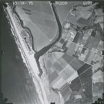
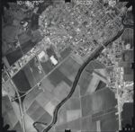
1975 Santa Cruz County Flight SCZCO 1-169
 Creator:Type:Place:Date Created:1975Subject:Pajaro River
 -
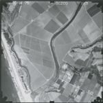
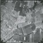
1975 Santa Cruz County Flight SCZCO 1-170
 Creator:Type:Place:Date Created:1975Subject:Pajaro River
 -
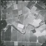
1975 Santa Cruz County Flight SCZCO 1-171
 Creator:Type:Place:Date Created:1975Subject:Pajaro River
 -
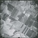
1975 Santa Cruz County Flight SCZCO 1-172
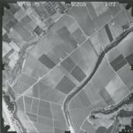 Creator:Type:Place:Date Created:1975Subject:Pajaro River
 -
1975 Santa Cruz County Flight SCZCO 1-173
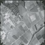 Creator:Type:Place:Date Created:1975Subject:Pajaro River
 -
1975 Santa Cruz County Flight SCZCO 1-210
 Creator:Type:Place:Date Created:1975Subject:Pajaro River
 -
1975 Santa Cruz County Flight SCZCO 1-211
 Creator:Type:Place:Date Created:1975Subject:Pajaro River
 -
1975 Santa Cruz County Flight SCZCO 1-212
 Creator:Type:Place:Date Created:1975Subject:Pajaro River
 -
1975 Santa Cruz County Flight SCZCO 1-214
 Creator:Type:Place:Date Created:1975Subject:Pajaro River
 -
1975 Santa Cruz County Flight SCZCO 1-213
 Creator:Type:Place:Date Created:1975Subject:Pajaro River
 -
1975 Santa Cruz County Flight SCZCO 1-215
 Creator:Type:Place:Date Created:1975Subject:Pajaro River
 -
1975 Santa Cruz County Flight SCZCO 1-216
 Creator:Type:Place:Date Created:1975Subject:Pajaro River
 -
1975 Santa Cruz County Flight SCZCO 1-243
 Creator:Type:Place:Date Created:1975Subject:Pajaro River
 -
1975 Santa Cruz County Flight SCZCO 1-244
 Creator:Type:Place:Date Created:1975Subject:Pajaro River
 -
1975 Santa Cruz County Flight SCZCO 1-245
 Creator:Type:Place:Date Created:1975Subject:Pajaro River
 -
1975 Santa Cruz County Flight SCZCO 2-1
 Creator:Type:Place:Date Created:1975Subject:Pajaro River
 -
1975 Santa Cruz County Flight SCZCO 2-2
 Creator:Type:Place:Date Created:1975Subject:Pajaro River
 -
1975 Santa Cruz County Flight SCZCO 2-21
 Creator:Type:Place:Date Created:1975Subject:Pajaro River
 -
1975 Santa Cruz County Flight SCZCO 2-22
 Creator:Type:Place:Date Created:1975Subject:Pajaro River
 -
1975 Santa Cruz County Flight SCZCO 2-23
 Creator:Type:Place:Date Created:1975Subject:Pajaro River
 -
1975 Santa Cruz County Flight SCZCO 2-25
 Creator:Type:Place:Date Created:1975Subject:Pajaro River
 -
1975 Santa Cruz County Flight SCZCO 2-24
 Creator:Type:Place:Date Created:1975Subject:Pajaro River
 -
1975 Santa Cruz County Flight SCZCO 2-26
 Creator:Type:Place:Date Created:1975Subject:Pajaro River
 -
1975 Santa Cruz County Flight SCZCO 2-39
 Creator:Type:Place:Date Created:1975Subject:Pajaro River
 -
1975 Santa Cruz County Flight SCZCO 2-40
 Creator:Type:Place:Date Created:1975Subject:Pajaro River
 -
1975 Santa Cruz County Flight SCZCO 2-41
 Creator:Type:Place:Date Created:1975Subject:Pajaro River
 -
1975 Santa Cruz County Flight SCZCO 2-42
 Creator:Type:Place:Date Created:1975Subject:Pajaro River
 -
1975 Santa Cruz County Flight SCZCO 2-44
 Creator:Type:Place:Date Created:1975Subject:Pajaro River
 -
1975 Santa Cruz County Flight SCZCO 2-43
 Creator:Type:Place:Date Created:1975Subject:Pajaro River
 -
1975 Santa Cruz County Flight SCZCO 2-45
 Creator:Type:Place:Date Created:1975Subject:Pajaro River
 -
1975 Santa Cruz County Flight SCZCO 2-54
 Creator:Type:Place:Date Created:1975Subject:Pajaro River
 -
1975 Santa Cruz County Flight SCZCO 2-55
 Creator:Type:Place:Date Created:1975Subject:Pajaro River
 -
1975 Santa Cruz County Flight SCZCO 2-56
 Creator:Type:Place:Date Created:1975Subject:Pajaro River
 -
1975 Santa Cruz County Flight SCZCO 2-57
 Creator:Type:Place:Date Created:1975Subject:Pajaro River
 -
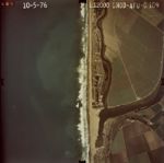
1976-77 Color California Coastline Flight DNOD-AFU-C 107
 Creator:Type:Place:Topic:Date Created:1977Subject:Coasts--California and Pajaro River
 -
1976-77 Color California Coastline Flight DNOD-AFU-C 108
 Creator:Type:Place:Topic:Date Created:1977Subject:Coasts--California and Pajaro River
 -
1976-77 Color California Coastline Flight DNOD-AFU-C 109
 Creator:Type:Place:Topic:Date Created:1977Subject:Coasts--California and Pajaro River
 -
1976-77 Color California Coastline Flight DNOD-AFU-C 125
 Creator:Type:Place:Topic:Date Created:1977Subject:Coasts--California and Pajaro River
 -
1976-77 Color California Coastline Flight DNOD-AFU-C 126
 Creator:Type:Place:Topic:Date Created:1977Subject:Coasts--California and Pajaro River
 -
1976-77 Color California Coastline Flight DNOD-AFU-C 127
 Creator:Type:Place:Topic:Date Created:1977Subject:Coasts--California and Pajaro River
 -
1976-77 Color California Coastline Flight DNOD-AFU-C 129
 Creator:Type:Place:Topic:Date Created:1977Subject:Coasts--California and Pajaro River
Limit your search
- Image124
- Collection2
- Pajaro River[remove]128
- Watsonville Slough13
- Pacific Ocean10
- Watsonville10
- Pajaro Valley6
- more Places »
- UC Santa Cruz Aerial Photographs Collection[remove]128
- 1975 Santa Cruz County Flight SCZCO34
- 1939-A Santa Cruz County Flight CJA17
- 1937 Santa Cruz County and Monterey County Flight 13-ABG11
- 1986-87 Color Central California Coastline Flights CDBW-APU-C and CC-APU-C10
- 1976-77 Color California Coastline Flight DNOD-AFU-C9
- 1989-I Monterey Bay Coastline Flight USGS Monterey Bay8
- 1974-Color San Andreas Fault Zone Flight7
- 2001 Santa Cruz County Coastline Flight CCC-BQK-C7
- 1928-G California Coastline Flight6
- 1935 Santa Cruz County Flight C-33006
- 1970 California Coastline Flight4
- more Collections »